Central Question
How did Pacific communities turn ocean knowledge, treaties, protest, decolonization, and climate diplomacy into claims about sovereignty and survival?
Start With These Dates
- c. 1600 BCELapita Expansion Begins
Lapita communities expanded across island chains, carrying pottery styles, seafaring knowledge, crops, animals, and settlement practices into the western Pacific.
- c. 900 CEHawaiian Settlement Expands
Polynesian settlement expanded in Hawaii through ocean navigation, voyaging knowledge, agriculture, kinship, and island adaptation.
- c. 1000 CEEastern Polynesia Settlement Expands
Polynesian voyagers expanded settlement across distant eastern Pacific islands, using navigation, canoe technology, ecological knowledge, and social networks.
- c. 1200 CETongan Maritime Chiefdom Expands
Tongan chiefly power expanded through voyaging, tribute, kinship, and maritime connections across parts of the central Pacific.
- 1810Kamehameha Unifies Hawaii
Kamehameha I unified the Hawaiian Islands after warfare, diplomacy, and control of changing military technologies.
- 1988Bougainville Conflict Begins
Conflict began in Bougainville amid disputes over mining, environmental damage, autonomy, and state authority.
- 2015Small Island States Push the Paris Agreement
Small island states, including Pacific voices, pushed climate diplomacy toward recognizing survival, sea-level rise, and the 1.5 degree goal.
Sources Used Here
- Te Ara: Pacific migrations
Reference for Pacific voyaging, settlement routes, Polynesian migration, and Aotearoa context.
- Te Ara: Tupaia
Pacific-based biographical reference for Tupaia's navigation, mediation, and role during Cook's voyage.
- University of Hawaii ScholarSpace: Epeli Hau'ofa, Our Sea of Islands
Pacific scholar's argument for reading Oceania as a connected sea of islands rather than scattered small places.
- Waitangi Tribunal: Treaty claims and Te Tiriti
Pacific-based institutional reference for Te Tiriti, Maori claims, Crown obligations, and treaty interpretation.
- Encyclopaedia Britannica: Hawaii history
Reference for Hawaiian settlement, kingdom history, and later United States annexation.
Pacific and Oceania Sovereignty and Climate is designed as a route, not a folder. It gathers events that answer related reader questions about power, belief, conflict, exchange, institutions, and memory. The strongest way to read the page is to move from the earliest events toward the later ones, watching how one kind of pressure changes form across different places.
The route currently runs from c. 1600 BCE to 2015. That span lets readers compare immediate turning points with slower consequences: the founding of institutions, the spread of ideas, the shock of war or disease, and the way later societies reused earlier events as warnings, models, or symbols.
Start with Lapita Expansion Begins, Eastern Polynesia Settlement Expands, Hawaiian Settlement Expands, Tongan Maritime Chiefdom Expands, Maori Settlement of Aotearoa and then follow the internal links into people, timelines, years, maps, and source lists. The route structure stays visible when each event explains why it belongs with the others and where the next useful page is.
Compare the events by scale. Some are concentrated moments, such as a battle, proclamation, trial, or publication. Others are long processes, such as a reform movement, pandemic, trade route, or diplomatic order. Reading both types together helps prevent the page from becoming a list of dates.
A useful route keeps uncertainty visible. Historical change rarely has one cause or one clean ending, so the reader can separate background pressure, immediate trigger, turning point, result, and later memory. That pattern is what makes the atlas expandable without making the reader start over each time.
This route is also a comparison tool. After reading one event, compare it with a later event on the same page and ask what changed in scale, language, geography, technology, authority, or public memory. The comparison is often more useful than the individual summary because it reveals the pattern the topic page is built to expose. When a claim feels too neat, open the full event page and check whether the evidence supports one cause, several causes, or a contested interpretation before moving on.
Pacific history becomes much richer when the ocean is treated as infrastructure rather than emptiness. Lapita expansion, Polynesian settlement, Hawaii, Tonga, Maori settlement, Rapa Nui, and Pacific voyaging show that distance could be made usable through navigation, memory, kinship, crops, canoes, and island knowledge. That older route matters before any European ship appears.
The colonial section follows Australia, Hawaii, Waitangi, the Maori King Movement, and the overthrow of the Hawaiian Kingdom. These events ask how empire claimed sovereignty in places where Indigenous law, monarchy, treaty language, land tenure, and political authority already existed. The answer differs by place, but the shared problem is clear: outside powers often turned maps, texts, troops, and settlers into claims over land and government.
The modern section follows ANZUS, nuclear testing, Papua New Guinea independence, nuclear-free New Zealand, Bougainville, and climate diplomacy. This route makes the Pacific central to Cold War militarization, environmental harm, decolonization, resource extraction, and climate justice. Small island states are not marginal victims in this story; they are diplomatic actors who changed global language around survival.
The hub creates a reason to keep reading because every page answers a concrete question: how did people cross the ocean, who had sovereignty, what did treaties claim, who paid the cost of nuclear testing, and why did climate diplomacy become a Pacific historical issue?
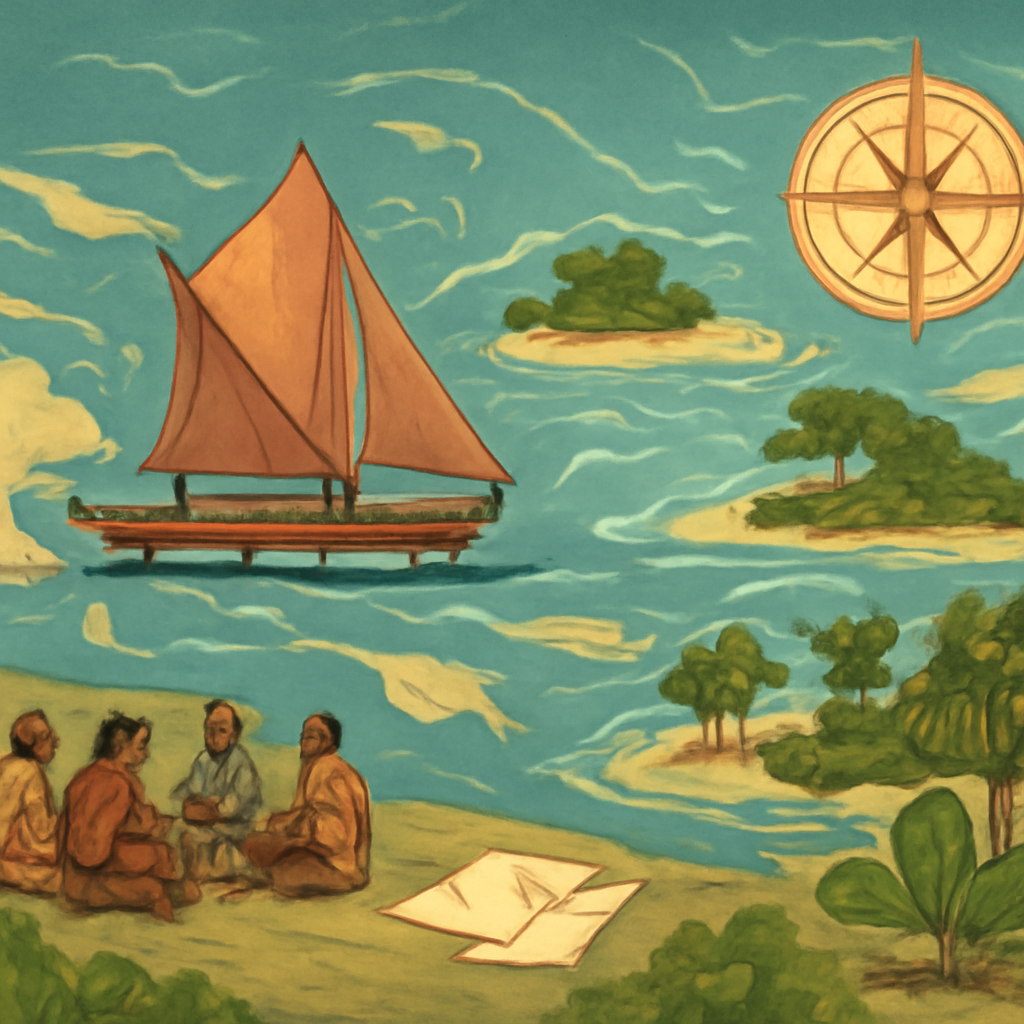
The route begins with voyaging because Pacific history is often flattened by maps that make the ocean look empty. Canoes, stars, currents, winds, birds, reefs, genealogies, chants, settlement memory, and crop transfers made distance knowable. Lapita expansion and Polynesian settlement reveal skill, experimentation, family movement, and ecological adaptation. The ocean was not a barrier first; it was a learned environment.
Island societies were not all the same. Hawaii, Tonga, Aotearoa New Zealand, Rapa Nui, Samoa, Fiji, Papua New Guinea, and many smaller island worlds had different political forms, resource limits, languages, sacred landscapes, and exchange networks. Some developed hierarchical kingdoms; some built confederations or chiefly systems; some faced environmental stress; some maintained dispersed authority across islands. The route becomes more accurate when island diversity stays visible.
Australia and Aotearoa add settler-colonial questions to the Pacific frame. First Peoples and Maori communities had law, land relationships, trade, diplomacy, and political authority before British claims. The Treaty of Waitangi matters because translation, sovereignty, protection, land sales, and Crown authority were contested from the beginning. Treaty language did not settle power; it became a living argument over land, governance, and historical repair.
Hawaii gives the route a monarchy and overthrow lens. The Hawaiian Kingdom engaged diplomacy, law, Christianity, trade, sugar interests, foreign residents, constitutional conflict, and U.S. strategic pressure. The overthrow was not an inevitable collision between tradition and modernity. It was a political crisis involving local actors, foreign planters, military presence, and competing ideas of sovereignty. That complexity helps readers avoid a simple victim-only narrative.
The Maori King Movement shows Indigenous political innovation under pressure. It was a response to land loss, settler expansion, Crown authority, and the need for collective voice. The movement reveals that Indigenous politics did not only resist; it built institutions, symbols, alliances, and diplomatic claims. This makes the Pacific route a story of political creativity as well as dispossession.
Cold War militarization changed the region's global position. ANZUS, nuclear testing, bases, strategic islands, and anti-nuclear movements show how great powers used Pacific space for security projects. Nuclear tests were not remote technical events. They affected bodies, food, water, land, migration, memory, and trust. The Pacific became a proving ground for weapons while Pacific peoples demanded recognition of harm.
Papua New Guinea and Bougainville bring resource extraction and postcolonial state formation into the route. Independence created new institutions, but mining, local autonomy, environmental damage, compensation, armed conflict, and regional identity tested the state. Bougainville shows that sovereignty can fracture when communities experience resource extraction as damage rather than development. The route therefore links decolonization with land and ecological justice.
Climate diplomacy gives the route its contemporary force. Sea-level rise, storms, saltwater intrusion, relocation, fisheries, freshwater stress, and loss of ancestral land make climate change a historical issue, not only a scientific forecast. Pacific states and communities changed global language by speaking about survival, responsibility, loss and damage, and the rights of people whose homes face physical transformation.
The evidence base is broad. Archaeology traces Lapita pottery and settlement; oral traditions preserve voyaging, genealogy, and place; treaty texts reveal contested translation; missionary and colonial archives show outside power; petitions and speeches show Indigenous political claims; environmental data records climate pressure; testimony records nuclear harm and displacement. The reader learns more when these sources are compared rather than collapsed.
Visual material has to make scale work. A globe can make islands vanish; a close map can hide oceanic connection. Useful visuals show canoe routes, island chains, reefs, treaty locations, nuclear test sites, resource zones, migration paths, and climate-vulnerable coastlines. The route needs images that reveal real geography and lived place, not distant blue abstraction.
The route also connects to other atlas paths. Prehistory explains early migration and settlement. Indigenous Americas helps compare sovereignty claims after colonization. Cold War history explains nuclear testing and alliances. Decolonization explains Papua New Guinea and Bougainville. Climate and contemporary crisis explain why small island states became major diplomatic voices. The Pacific is therefore a connector, not an edge case.
A reader looking for Pacific history, Oceania timeline, Treaty of Waitangi, Hawaiian overthrow, nuclear testing, or climate diplomacy can enter through different doors. The hub's synthesis is that sovereignty in the Pacific has always involved movement, land, ocean knowledge, outside claims, military strategy, environmental damage, and diplomatic creativity. That synthesis keeps the route coherent across deep time and the present.
The final reading path moves from voyaging to settlement, then to treaty and monarchy, then to militarization, decolonization, resource conflict, and climate diplomacy. Each stage asks who has authority over land and ocean, who carries memory, who bears environmental cost, and who gets to speak for survival. That question gives the Pacific route its pull.
The route also needs to make migration visible after colonization. Pacific Islanders moved for labor, mission education, military service, seasonal work, mining, plantations, urban employment, and climate-related pressure. These movements created diasporas in New Zealand, Australia, the United States, and beyond. Migration did not erase island belonging. It often extended family obligation, remittances, politics, and language across oceans.
Health and environment connect older and modern sections. Introduced disease, mission settlement, plantation labor, nuclear fallout, mining pollution, changing fisheries, and climate stress all changed bodies and ecosystems. These pressures operated differently across islands, but they share a theme: outside systems often treated Pacific places as remote while Pacific communities experienced consequences intimately.
Diplomacy gives the modern Pacific an active voice. Pacific leaders and communities used regional forums, anti-nuclear campaigns, United Nations speeches, climate negotiations, legal claims, and cultural diplomacy to change global language. The route becomes stronger when readers see Pacific peoples as agenda-setters, not only as communities affected by empire, militarization, or rising seas.
The internal reading path links naturally to other site sections. Voyaging connects to prehistory and migration. Treaty disputes connect to Indigenous sovereignty. Nuclear testing connects to Cold War and science. Bougainville connects to decolonization and resource extraction. Climate diplomacy connects to contemporary crisis. Those links make the Pacific visible across the atlas rather than isolated at the edge.
The route also benefits from a people-first reading. Navigators, elders, farmers, chiefs, queens, treaty translators, mission students, miners, anti-nuclear campaigners, migrants, climate negotiators, and families facing relocation all enter the story at different points. Naming that range keeps the Pacific from becoming only blue space or diplomatic shorthand.
The closing synthesis is that Pacific history is a history of skilled movement and contested authority. Ocean knowledge made settlement possible; colonial power challenged land and sovereignty; military systems treated islands as strategic platforms; climate change turned survival into diplomacy. The route remains compelling because every stage asks how communities defended place while living through forces that crossed the ocean, and how they turned memory, law, navigation, protest, and diplomacy into tools for future survival, cultural continuity, environmental repair, regional solidarity, political voice, ancestral responsibility, community memory, and public history.
A final comparison keeps the region from feeling small. Hawaii explains monarchy and foreign pressure; Waitangi explains treaty dispute; nuclear testing explains strategic harm; Bougainville explains resource conflict; climate diplomacy explains survival politics. These entries give the Pacific route a spine that reaches from voyaging knowledge to contemporary international law.
The Pacific hub works best when the ocean is treated as a learned environment. Canoes, stars, currents, reefs, crops, kinship, chants, genealogies, and island knowledge made movement possible long before imperial charts. That opening gives readers a reason to treat Pacific history as a center of world history rather than a remote edge.
Sovereignty gives the route its middle spine. Waitangi, Hawaiian monarchy, settler expansion, Maori political organization, colonial rule, nuclear testing, Papua New Guinea independence, Bougainville, and regional diplomacy all ask who has authority over land, ocean, memory, and future risk. The answers differ by island world, but the shared tension is clear: outside systems often called the Pacific remote while using it for settlement, strategy, resources, and military testing.
Climate diplomacy reads here as history, not as a late environmental add-on. Sea-level rise, freshwater stress, storms, relocation, fisheries, loss and damage, and international negotiations belong to a longer story of Pacific communities defending place under pressure. The hub becomes stronger when readers see island states and Indigenous communities as agenda-setters who changed global political language.
Read the events in order first; the page is built to reveal change over time.
Ask which pressures existed before the visible turning point and which actors had room to choose.
Follow what changed afterward in institutions, borders, law, belief, or everyday life.
Notice which events became symbols and why later generations kept returning to them.
Read navigation and settlement as technologies of memory, environment, stars, winds, currents, and community.
Compare Waitangi, Hawaii, Australia, and Maori politics as different contests over authority and land.
Follow nuclear testing and climate diplomacy as modern forms of Pacific vulnerability and agency.
Compare kingdoms, chiefly systems, settler colonies, highland societies, and island networks without treating Oceania as one culture.
Use Bougainville, mining, climate loss, treaty claims, and nuclear testimony to follow harm, compensation, and justice.
Read navigation, treaty memory, nuclear testimony, migration, resource conflict, and climate diplomacy as connected Pacific evidence.
Choose a Reading Path
Start With the Timeline
Use the related timeline first when you want a chronological route through the topic.
Start with c. 1600 BCE: Lapita Expansion BeginsOpen a Person Page
Use people pages when the topic is easier to understand through leadership, resistance, reform, or memory.
Start with c. 900 CE: Hawaiian Settlement ExpandsUse Year Pages
Use year pages when you need a fast answer to what changed in a specific year.
Start with c. 1000 CE: Eastern Polynesia Settlement ExpandsReturn to the Map
Use the map to keep geography visible while moving between events and regions.
Start with c. 1200 CE: Tongan Maritime Chiefdom ExpandsStart With Voyaging
Use Lapita expansion, Polynesian settlement, and Pacific navigation to see the ocean as learned infrastructure rather than empty distance.
Start with 1810: Kamehameha Unifies HawaiiFollow Sovereignty Claims
Move through Australia, Waitangi, the Maori King Movement, and Hawaii to compare treaty language, monarchy, land, and colonial pressure.
Start with 1988: Bougainville Conflict BeginsRead Militarized Ocean
Use ANZUS, nuclear testing, and nuclear-free New Zealand to connect Cold War strategy with environmental and bodily harm.
Start with 2015: Small Island States Push the Paris AgreementEnd With Climate Diplomacy
Move through Papua New Guinea, Bougainville, and climate diplomacy to see resource conflict, decolonization, and survival politics.
How the Story Builds
Begin with Lapita Expansion Begins. The opening event usually shows the pressure that made the route necessary: a crisis of authority, an expanding exchange system, a new technology, a contested idea, or a conflict that older institutions could no longer contain.
Kamehameha Unifies Hawaii works as a checkpoint because it lets readers ask what had become irreversible, which actors still had choices, and how the route changed scale between the opening event and the later consequences.
The later edge of the route includes Nuclear Free New Zealand Act, Bougainville Conflict Begins, and Small Island States Push the Paris Agreement. These pages help readers see what survived beyond the first shock: institutions, borders, laws, memories, technologies, movements, or arguments that kept shaping later history.
The route is easier to remember through people and places. Watch figures such as Lapita communities, Polynesian voyagers, Polynesian navigators, Hawaiian communities, Tongan chiefs, and Pacific voyagers move through settings such as Bismarck Archipelago, Eastern Polynesia, Hawaiian Islands, Tonga, and Aotearoa New Zealand; that is where large structures become visible as choices, risks, costs, and memories.
Lapita and Polynesian routes show canoes, crops, stars, currents, memory, and kinship turning ocean distance into history.
Hawaii, Tonga, Maori settlement, Rapa Nui, and other societies show varied political forms, sacred landscapes, and ecological limits.
Australia, Waitangi, the Maori King Movement, and Hawaii reveal how outside claims met existing authority and land relationships.
ANZUS, nuclear tests, and anti-nuclear politics connect Cold War strategy to testimony, contamination, and regional protest.
Papua New Guinea, Bougainville, and climate diplomacy show sovereignty shaped by resources, environment, migration, and survival claims.
- Which event in Pacific and Oceania Sovereignty and Climate feels like the true point of no return, and why might another reader choose a different event?
- What changes if the route is read from the perspective of ordinary people rather than rulers, armies, inventors, reformers, or institutions?
- Which consequence was immediate, and which consequence only became clear decades later?
- Where does the map change the interpretation by showing distance, borders, routes, ports, capitals, or frontiers?
- Why is the Pacific a historical connector rather than a blank space?
- How did treaty language and monarchy shape sovereignty disputes?
- What made nuclear testing a colonial and environmental issue?
- How did small island states change global climate politics?
- How can maps show both oceanic scale and the intimacy of island places?
- What changes when climate diplomacy is read as history rather than only future risk?
- How does Pacific history change when the ocean is a route system rather than empty space?
- Why do climate claims carry older histories of sovereignty, colonization, military harm, and migration?
Interactive Timeline
Follow Pacific and Oceania Sovereignty and Climate by sequence
Lapita Expansion Begins
Lapita communities expanded across island chains, carrying pottery styles, seafaring knowledge, crops, animals, and settlement practices into the western Pacific.
Read the full event pageMap Layer
Pacific and Oceania Sovereignty and Climate geography
Gold pins mark the approximate locations of published event pages. This is a schematic locator map, not a historical border map.
Coordinates are approximate and are used to help readers orient themselves before opening a full event page.
Route Events
Events in This Topic
Lapita Expansion Begins
Lapita communities expanded across island chains, carrying pottery styles, seafaring knowledge, crops, animals, and settlement practices into the western Pacific.
Hawaiian Settlement Expands
Polynesian settlement expanded in Hawaii through ocean navigation, voyaging knowledge, agriculture, kinship, and island adaptation.
Eastern Polynesia Settlement Expands
Polynesian voyagers expanded settlement across distant eastern Pacific islands, using navigation, canoe technology, ecological knowledge, and social networks.
Tongan Maritime Chiefdom Expands
Tongan chiefly power expanded through voyaging, tribute, kinship, and maritime connections across parts of the central Pacific.
Maori Settlement of Aotearoa
Polynesian settlers established Maori communities in Aotearoa New Zealand, adapting voyaging traditions, agriculture, social organization, and place knowledge to new islands.
Rapa Nui Moai Building Peaks
Rapa Nui communities built and moved moai, linking ancestors, authority, labor, engineering, and landscape.
James Cook Arrives at Tahiti
James Cook's arrival at Tahiti connected British scientific voyaging with Pacific knowledge, Polynesian diplomacy, astronomy, mapping, and future imperial contact.
Cook Claims Eastern Australia
James Cook mapped parts of Australia's eastern coast and claimed territory for Britain despite Indigenous presence and sovereignty.
First Fleet Arrives in Australia
The First Fleet established a British penal colony at Sydney Cove, beginning a new phase of colonization and Indigenous dispossession.
Kamehameha Unifies Hawaii
Kamehameha I unified the Hawaiian Islands after warfare, diplomacy, and control of changing military technologies.
Treaty of Waitangi
Maori rangatira and British representatives signed Te Tiriti o Waitangi, a treaty whose texts and meanings remain central to New Zealand history.
Maori King Movement Founded
The Maori King Movement formed to protect land, unity, and authority amid expanding colonial settlement.
Overthrow of the Hawaiian Kingdom
A group of foreign residents backed by United States power overthrew Queen Liliuokalani and the Hawaiian Kingdom.
ANZUS Treaty Signed
Australia, New Zealand, and the United States signed the ANZUS security treaty in the early Cold War Pacific.
French Nuclear Testing Begins at Moruroa
France began nuclear testing at Moruroa, turning Pacific islands into sites of nuclear geopolitics and anti-nuclear protest.
Papua New Guinea Gains Independence
Papua New Guinea became independent from Australian administration, creating a new Pacific state across highly diverse communities and languages.
Nuclear Free New Zealand Act
New Zealand passed nuclear-free legislation that restricted nuclear-powered and nuclear-armed vessels and reshaped alliance politics.
Bougainville Conflict Begins
Conflict began in Bougainville amid disputes over mining, environmental damage, autonomy, and state authority.
Small Island States Push the Paris Agreement
Small island states, including Pacific voices, pushed climate diplomacy toward recognizing survival, sea-level rise, and the 1.5 degree goal.
References
Where to Check the Facts
- Te Ara: Pacific migrationsReference for Pacific voyaging, settlement routes, Polynesian migration, and Aotearoa context.
- Te Ara: TupaiaPacific-based biographical reference for Tupaia's navigation, mediation, and role during Cook's voyage.
- University of Hawaii ScholarSpace: Epeli Hau'ofa, Our Sea of IslandsPacific scholar's argument for reading Oceania as a connected sea of islands rather than scattered small places.
- Waitangi Tribunal: Treaty claims and Te TiritiPacific-based institutional reference for Te Tiriti, Maori claims, Crown obligations, and treaty interpretation.
- Encyclopaedia Britannica: Hawaii historyReference for Hawaiian settlement, kingdom history, and later United States annexation.
- Encyclopaedia Britannica: Te Tiriti o WaitangiReference for the Treaty of Waitangi and British annexation of New Zealand.
- Official UNESCO World Heritage Centre: TaputapuateaInstitutional reference for a Polynesian cultural landscape connected to voyaging, ritual, genealogy, and ocean routes.
- Official NZ History: Nuclear testing in the PacificReference for French nuclear testing in the Pacific and regional protest.
- Moruroa Files: Investigation into French nuclear tests in the PacificInvestigative reference for declassified-record analysis and contested health-impact claims around French Polynesian nuclear testing.
- Bougainville Referendum Commission: PublicationsOfficial reference for Bougainville referendum materials, voter information, observers, and public communication.
- PaCSIA: Bougainville Referendum DialoguesCivil-society reference for Bougainville dialogue work, referendum education, and local peace-process participation.
- Pacific Islands Forum: 2050 Strategy for the Blue Pacific ContinentPacific regional institutional reference for climate diplomacy, ocean governance, security, and shared Blue Pacific strategy.
- Encyclopaedia Britannica: Papua New GuineaReference for Papua New Guinea's independence and modern state formation.