Central Question
How does world history change when Indigenous American cities, states, landscapes, and resistance are treated as central rather than as a prelude to conquest?
Start With These Dates
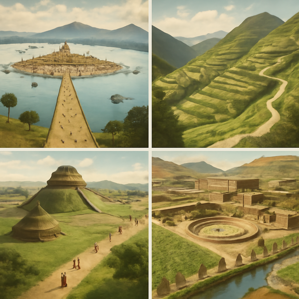
- c. 1200 BCEOlmec Centers Flourish
Olmec centers on the Gulf Coast developed monumental sculpture, ritual landscapes, and elite authority that influenced later Mesoamerican societies.
- c. 900 BCEChavin Culture Flourishes
Chavin de Huantar became a major Andean ceremonial center, linking ritual practice, art, pilgrimage, and highland exchange.
- c. 500 BCEMonte Alban Founded
Zapotec leaders developed Monte Alban on a hilltop above the Oaxaca Valley, creating one of Mesoamerica's earliest major urban centers.
- c. 200 BCE-600 CENazca Lines Created
Nazca communities created large geoglyphs in the desert, turning landscape, movement, ritual, and visibility into historical evidence.
- c. 1100 CEPueblo Bonito Flourishes
Pueblo Bonito and the wider Chaco system linked architecture, roads, ritual space, exchange, and social organization across the Southwest.
- 1680Pueblo Revolt
Pueblo communities coordinated a revolt that temporarily expelled Spanish authorities and missionaries from New Mexico.
- 1994Zapatista Uprising
The Zapatista uprising in Chiapas challenged Mexican state power, Indigenous marginalization, land inequality, and neoliberal globalization.
Sources Used Here
- Smithsonian National Museum of the American Indian: Native Knowledge 360
Indigenous-centered educational reference for Native history, sovereignty, community knowledge, and public interpretation.
- Smithsonian NMAI: Haudenosaunee Guide for Educators
Community-consulted educational reference for Haudenosaunee culture, history, continuity, and interpretation.
- Yale History: Ned Blackhawk, The Rediscovery of America
Indigenous historian's synthesis for centering Native peoples in broader American historical interpretation.
- Indigenous Chicago
Community-partnered public-history project for place-based Native history, maps, memory, and continuity.
- Encyclopaedia Britannica: Pre-Columbian civilizations
Reference for pre-Columbian civilizations in Mesoamerica and the Andes before European conquest.
Indigenous Americas and Pre-Columbian Civilizations is designed as a route, not a folder. It gathers events that answer related reader questions about power, belief, conflict, exchange, institutions, and memory. The strongest way to read the page is to move from the earliest events toward the later ones, watching how one kind of pressure changes form across different places.
The route currently runs from c. 1200 BCE to 1994. That span lets readers compare immediate turning points with slower consequences: the founding of institutions, the spread of ideas, the shock of war or disease, and the way later societies reused earlier events as warnings, models, or symbols.
Start with Olmec Centers Flourish, Chavin Culture Flourishes, Monte Alban Founded, Nazca Lines Created, Teotihuacan Reaches Its Urban Peak and then follow the internal links into people, timelines, years, maps, and source lists. The route structure stays visible when each event explains why it belongs with the others and where the next useful page is.
Compare the events by scale. Some are concentrated moments, such as a battle, proclamation, trial, or publication. Others are long processes, such as a reform movement, pandemic, trade route, or diplomatic order. Reading both types together helps prevent the page from becoming a list of dates.
A useful route keeps uncertainty visible. Historical change rarely has one cause or one clean ending, so the reader can separate background pressure, immediate trigger, turning point, result, and later memory. That pattern is what makes the atlas expandable without making the reader start over each time.
This route is also a comparison tool. After reading one event, compare it with a later event on the same page and ask what changed in scale, language, geography, technology, authority, or public memory. The comparison is often more useful than the individual summary because it reveals the pattern the topic page is built to expose. When a claim feels too neat, open the full event page and check whether the evidence supports one cause, several causes, or a contested interpretation before moving on.
This hub changes the starting point for American history. It begins with Indigenous cities, ceremonial centers, landscapes, roads, writing systems, agriculture, and political authority before European contact. Olmec centers, Chavin, Monte Alban, Nazca, Teotihuacan, Maya city-states, Tiwanaku, Cahokia, Chaco, Tenochtitlan, and Cusco show that the Americas contained many kinds of historical complexity long before conquest.
The route is deliberately regional instead of using one generic label. Mesoamerica gives readers cities, writing, calendars, tribute, markets, and lake ecology. The Andes give readers mountains, roads, labor obligations, storehouses, ritual landscapes, and imperial logistics. The Mississippi Valley and Southwest give readers mounds, plazas, great houses, road systems, and debates over authority. Those regions cannot be flattened into one civilization.
Conquest appears late in the route because it must be explained against what already existed. The fall of the Aztec and Inca empires involved disease, Spanish violence, Indigenous allies, civil conflict, diplomacy, translation, and imperial vulnerabilities. A thin conquest page makes Europe the actor and the Americas the setting. This hub reverses that habit by making Indigenous institutions visible first.
The route also refuses to end in 1533. The Pueblo Revolt and Zapatista uprising show that Indigenous politics, memory, land defense, and sovereignty claims continued after conquest and colonial rule. The result is a more honest search answer: pre-Columbian civilizations matter not only because they came before Columbus, but because their descendants, landscapes, and political claims remain part of history.
The route begins with deep regional complexity because the Americas were never one cultural zone. Olmec centers, Chavin ceremonial worlds, Monte Alban, Nazca geoglyphs, Teotihuacan, Maya city-states, Tiwanaku, Cahokia, Chaco, Tenochtitlan, and Cusco each organized power through different landscapes and institutions. Some built cities around plazas and temples; others used roads, mounds, terraces, storehouses, water systems, markets, calendars, and tribute networks.
Evidence changes from region to region. Maya inscriptions preserve dynastic names and events in ways that many North American mound sites do not. Andean knotted records, architecture, roads, and Spanish-era accounts require a different reading practice from Mesoamerican codices. Archaeology, ecology, oral tradition, colonial documents, language evidence, and living community knowledge all contribute, but none of them tells the whole story alone.
Agriculture gives the route an everyday foundation. Maize, beans, squash, potatoes, quinoa, cacao, chili, manioc, and other crops shaped settlement, diet, ritual, labor, and political power. Farming knowledge was not background. It made dense communities possible in river valleys, highlands, forests, lake basins, and coastal deserts. The route becomes more human when food systems sit beside temples, rulers, and battles.
Mesoamerica gives readers several political forms. Olmec centers show early monumental and ritual authority; Teotihuacan shows urban scale and regional influence; Maya city-states show writing, calendars, court rivalry, and sacred kingship; Tenochtitlan shows lake engineering, tribute, markets, military alliance, and imperial ideology. These examples are linked, but not interchangeable. Their differences are what make the region historically rich.
The Andes require a different map. Chavin, Nazca, Tiwanaku, Wari, and Inca worlds were shaped by mountains, coastal deserts, highland basins, roads, vertical ecology, labor obligations, storehouses, and state movement through difficult terrain. Inca power depended on administration, resettlement, ritual, roads, runners, and the management of food and labor across ecological zones. The route shows an empire built through infrastructure as much as conquest.
North America belongs in the same large route without being treated as an appendix. Cahokia's mounds and plazas, Chaco's great houses and roads, and later Pueblo communities show settlement, ceremony, exchange, astronomy, migration, and authority north of Mesoamerica. These histories matter because they disrupt the old habit of placing complexity only in Mexico and the Andes while treating northern regions as empty or simple.
Conquest becomes more accurate when Indigenous allies and rivalries remain visible. The fall of the Aztec and Inca empires involved Spanish violence, disease, horses, steel, gunpowder, translation, captive rulers, internal rivalries, subject peoples, civil war, and strategic decisions by Indigenous actors. Europe alone did not topple empires in a blank landscape. Conquest worked through existing political fractures and through catastrophes that no side fully controlled.
Disease belongs in the route because it changed the terms of power. Smallpox and other epidemics devastated communities, disrupted succession, weakened armies, broke families, and changed labor systems. Disease was not simply a natural backdrop. It interacted with war, forced movement, missionization, tribute demands, and colonial settlement. Reading disease historically keeps conquest from becoming a story of European superiority.
The Pueblo Revolt gives the route a crucial post-conquest hinge. It shows Indigenous communities organizing against mission pressure, forced labor, cultural suppression, and Spanish authority in the late seventeenth century. The event matters because it turns continuity into political action. Indigenous history did not end with conquest; communities adapted, resisted, negotiated, remembered, and rebuilt authority under colonial conditions.
Modern Indigenous movements extend the route into questions of land, language, autonomy, archaeology, museums, treaties, and sovereignty. The Zapatista uprising is not a pre-Columbian event, but it shows why pre-contact history still matters. Claims over land and dignity draw power from older histories without being trapped in the past. The route helps readers connect deep history with living political futures.
Visuals need to be specific. A generic ruin image can flatten the subject. Better visual logic distinguishes a Maya stela, a Mexica sculpture, a Nazca line, a Chaco great house, a Cahokia mound, an Andean road, a terraced field, or a colonial document. Each object teaches a different way power, memory, labor, and landscape became visible.
The source trail also requires humility. Colonial records often preserve Indigenous voices through hostile or administrative filters. Archaeological interpretation changes as methods improve. Oral traditions carry memory and belonging in forms that do not behave like colonial archives. Community protocols shape what can be shared and how. A careful route teaches readers to ask what kind of evidence they are seeing and whose authority frames it.
The common search question is often 'what were pre-Columbian civilizations?' The best answer is not a list of names. It is a comparison of cities, landscapes, food systems, writing, ritual, trade, war, infrastructure, and survival. The route gives readers a way to move from Olmec, Maya, Aztec, Inca, Cahokia, and Chaco into a larger understanding of American history before and after 1492.
The final reading path starts with built landscapes, moves through regional political systems, then reads conquest as an encounter with existing institutions, and ends with continuity and sovereignty. That path keeps the subject from becoming frozen in the past. It lets readers see Indigenous history as deep, diverse, interrupted, resilient, and still politically alive.
Trade and communication connect the route across distance. Shells, obsidian, copper, turquoise, cacao, textiles, feathers, ceramics, salt, and ritual knowledge moved through exchange networks that linked communities without making them identical. Roads, causeways, footpaths, river routes, and mountain corridors carried goods and messages. These systems show that complexity did not require European-style states or writing in every region.
The route also keeps collapse language under control. Some cities were abandoned, reorganized, or transformed because of drought, conflict, political change, trade shifts, environmental stress, or migration. That does not mean the people disappeared. Descendant communities, languages, farming knowledge, sacred places, and political claims continued in altered forms. A careful reader distinguishes the decline of a city from the disappearance of a people.
Museums and archaeology create modern stakes. Human remains, sacred objects, looted artifacts, site tourism, repatriation, and community authority all shape how the past is presented today. The route becomes more honest when readers see that evidence is not neutral property. It belongs to living debates over respect, research, teaching, and who has the right to interpret Indigenous history.
The internal reading path can move in several directions. A visitor searching for Aztec or Inca history can move outward to earlier Mesoamerican and Andean worlds. A visitor searching for Cahokia or Chaco can connect North America to wider American complexity. A visitor interested in conquest can move to disease, colonialism, and Indigenous resistance. The hub keeps those routes connected without making one region stand for all.
The closing synthesis is that Indigenous American history is not a prelude to European history. It is a long record of cities, food systems, sacred landscapes, migration, diplomacy, environmental knowledge, empire, catastrophe, adaptation, and continuing sovereignty. That frame gives readers a reason to keep moving across regions rather than stopping at one famous civilization.
A final comparison makes the route clearer for learners. Tenochtitlan explains lake urbanism and tribute; Cusco explains roads and highland administration; Cahokia explains mounds and regional gathering; Chaco explains architecture, roads, and debate over authority. None of these examples replaces the others. Together they show why the Americas need multiple centers of explanation.
This hub now has to feel like a new starting point for American history. The strongest doorway is not a single ruin or a list of famous names, but a landscape of cities, roads, maize fields, mounds, terraces, lake causeways, calendars, markets, and sacred places. Olmec, Maya, Mexica, Inca, Cahokia, Chaco, Pueblo, Andean, and other histories need to stand beside one another without being forced into one model of civilization.
The page becomes more engaging when it treats evidence as part of the story. Archaeology, inscriptions, oral memory, ecology, colonial accounts, material culture, and living community knowledge do not answer the same questions. Maya glyphs, Andean roads, Cahokia mounds, Chaco great houses, Mexica tribute, and Pueblo resistance each ask readers to use a different evidence habit. That method gives the hub intellectual texture instead of just more names.
Conquest and continuity belong in one frame. Spanish violence, disease, Indigenous allies, translation, civil conflict, and colonial labor systems changed existing worlds, but they did not erase Indigenous history. Pueblo resistance, land claims, language survival, museum debates, and modern sovereignty movements make the route alive after 1492. The hub leaves readers with continuity, not disappearance.
Read the events in order first; the page is built to reveal change over time.
Ask which pressures existed before the visible turning point and which actors had room to choose.
Follow what changed afterward in institutions, borders, law, belief, or everyday life.
Notice which events became symbols and why later generations kept returning to them.
Compare ceremonial centers, plazas, roads, mounds, geoglyphs, canals, and capitals as different ways of organizing authority.
Use archaeology, inscriptions, oral memory, ecology, and colonial records carefully because each source type preserves different voices.
Read conquest beside survival, adaptation, revolt, and modern Indigenous political claims.
Follow maize, potatoes, cacao, terraces, irrigation, storage, and labor to see how daily subsistence supported large societies.
Connect Pueblo resistance, land defense, language, museum debates, and modern movements to the survival of Indigenous political claims.
Compare lake cities, terraces, mounds, roads, great houses, canals, and fields as different ways communities organized power and memory.
Choose a Reading Path
Start With the Timeline
Use the related timeline first when you want a chronological route through the topic.
Start with c. 1200 BCE: Olmec Centers FlourishOpen a Person Page
Use people pages when the topic is easier to understand through leadership, resistance, reform, or memory.
Start with c. 900 BCE: Chavin Culture FlourishesUse Year Pages
Use year pages when you need a fast answer to what changed in a specific year.
Start with c. 500 BCE: Monte Alban FoundedReturn to the Map
Use the map to keep geography visible while moving between events and regions.
Start with c. 200 BCE-600 CE: Nazca Lines CreatedStart With Landscapes
Use mounds, roads, lake cities, terraces, geoglyphs, and plazas to see how authority was built into land and movement.
Start with c. 1100 CE: Pueblo Bonito FlourishesCompare Regions
Move between Mesoamerica, the Andes, North America, and the Southwest instead of treating the Americas as one civilization.
Start with 1680: Pueblo RevoltRead Conquest Against Institutions
Use Aztec and Inca falls to ask how disease, allies, internal politics, translation, and colonial violence interacted.
Start with 1994: Zapatista UprisingFollow Continuity
Use Pueblo Revolt and Zapatista pages to connect deep history with land, memory, language, and sovereignty after conquest.
How the Story Builds
Begin with Olmec Centers Flourish. The opening event usually shows the pressure that made the route necessary: a crisis of authority, an expanding exchange system, a new technology, a contested idea, or a conflict that older institutions could no longer contain.
Pueblo Bonito Flourishes works as a checkpoint because it lets readers ask what had become irreversible, which actors still had choices, and how the route changed scale between the opening event and the later consequences.
The later edge of the route includes Fall of the Inca Empire, Pueblo Revolt, and Zapatista Uprising. These pages help readers see what survived beyond the first shock: institutions, borders, laws, memories, technologies, movements, or arguments that kept shaping later history.
The route is easier to remember through people and places. Watch figures such as Olmec sculptors, Gulf Coast communities, Andean ritual specialists, Highland communities, Zapotec rulers, and Oaxaca Valley communities move through settings such as San Lorenzo and Gulf Coast lowlands, Chavin de Huantar, Monte Alban, Nazca Desert, and Teotihuacan; that is where large structures become visible as choices, risks, costs, and memories.
Olmec, Chavin, Monte Alban, Nazca, Teotihuacan, Maya cities, and other early centers show ritual, craft, astronomy, and authority.
Mesoamerican tribute, Andean roads, North American mounds, and Southwestern great houses reveal different political geographies.
Tenochtitlan and Cusco show markets, roads, labor, alliance, storage, sacred authority, and expansion before Spanish conquest.
Disease, Indigenous allies, internal conflicts, Spanish violence, translation, and forced labor changed existing societies violently.
Pueblo resistance and modern movements keep land, memory, language, autonomy, and political identity in the route.
- Which event in Indigenous Americas and Pre-Columbian Civilizations feels like the true point of no return, and why might another reader choose a different event?
- What changes if the route is read from the perspective of ordinary people rather than rulers, armies, inventors, reformers, or institutions?
- Which consequence was immediate, and which consequence only became clear decades later?
- Where does the map change the interpretation by showing distance, borders, routes, ports, capitals, or frontiers?
- What changes when American history starts with Cahokia, Teotihuacan, Chavin, and Cusco rather than 1492?
- How did geography shape power differently in Mesoamerica, the Andes, and North America?
- Why did Spanish conquest require Indigenous allies and local conflicts?
- How do modern Indigenous movements change the meaning of pre-Columbian history?
- Which evidence types preserve Indigenous voices, and which sources require extra caution?
- How do food systems, roads, water, and ritual landscapes change the definition of civilization?
- What changes when American history begins with Indigenous cities and landscapes rather than European arrival?
- How can a reader distinguish the decline of a city from the disappearance of a people?
Interactive Timeline
Follow Indigenous Americas and Pre-Columbian Civilizations by sequence
Olmec Centers Flourish
Olmec centers on the Gulf Coast developed monumental sculpture, ritual landscapes, and elite authority that influenced later Mesoamerican societies.
Read the full event pageMap Layer
Indigenous Americas and Pre-Columbian Civilizations geography
Gold pins mark the approximate locations of published event pages. This is a schematic locator map, not a historical border map.
Coordinates are approximate and are used to help readers orient themselves before opening a full event page.
Route Events
Events in This Topic
Olmec Centers Flourish
Olmec centers on the Gulf Coast developed monumental sculpture, ritual landscapes, and elite authority that influenced later Mesoamerican societies.
Chavin Culture Flourishes
Chavin de Huantar became a major Andean ceremonial center, linking ritual practice, art, pilgrimage, and highland exchange.
Monte Alban Founded
Zapotec leaders developed Monte Alban on a hilltop above the Oaxaca Valley, creating one of Mesoamerica's earliest major urban centers.
Nazca Lines Created
Nazca communities created large geoglyphs in the desert, turning landscape, movement, ritual, and visibility into historical evidence.
Teotihuacan Reaches Its Urban Peak
Teotihuacan grew into one of the largest cities in the pre-Columbian Americas, with monumental avenues, pyramids, apartment compounds, and regional influence.
Classic Maya City-States Peak
Classic Maya cities flourished through dynastic politics, writing, astronomy, ritual kingship, art, warfare, and regional exchange.
Tiwanaku State Expands
Tiwanaku expanded around Lake Titicaca, linking ritual authority, raised-field agriculture, architecture, and regional exchange.
Tula and Toltec Power Flourish
Tula became a major Postclassic center associated with Toltec political power, warrior imagery, trade, and later Mesoamerican memory.
Cahokia Rises
Cahokia expanded into the largest pre-Columbian urban center north of Mexico, with mounds, plazas, neighborhoods, and regional influence.
Pueblo Bonito Flourishes
Pueblo Bonito and the wider Chaco system linked architecture, roads, ritual space, exchange, and social organization across the Southwest.
Tenochtitlan Founded
Mexica settlers founded Tenochtitlan on an island in Lake Texcoco, building the urban base for later Aztec imperial power.
Aztec Triple Alliance Forms
Tenochtitlan, Texcoco, and Tlacopan formed the Triple Alliance, creating the political structure behind Aztec imperial expansion.
Inca Expansion under Pachacuti
Pachacuti and his successors transformed the Inca polity around Cusco into a rapidly expanding Andean empire.
Columbian Exchange Begins
After sustained transatlantic contact, plants, animals, pathogens, people, and forced labor systems moved across the Atlantic with world-changing consequences.
Fall of the Aztec Empire
Spanish forces and Indigenous allies captured Tenochtitlan after conflict, epidemic disease, and political fracture undermined Aztec power.
Fall of the Inca Empire
Spanish forces exploited civil conflict, alliances, disease, and coercion to break Inca imperial power and occupy Cusco.
Pueblo Revolt
Pueblo communities coordinated a revolt that temporarily expelled Spanish authorities and missionaries from New Mexico.
Zapatista Uprising
The Zapatista uprising in Chiapas challenged Mexican state power, Indigenous marginalization, land inequality, and neoliberal globalization.
References
Where to Check the Facts
- Smithsonian National Museum of the American Indian: Native Knowledge 360Indigenous-centered educational reference for Native history, sovereignty, community knowledge, and public interpretation.
- Smithsonian NMAI: Haudenosaunee Guide for EducatorsCommunity-consulted educational reference for Haudenosaunee culture, history, continuity, and interpretation.
- Yale History: Ned Blackhawk, The Rediscovery of AmericaIndigenous historian's synthesis for centering Native peoples in broader American historical interpretation.
- Indigenous ChicagoCommunity-partnered public-history project for place-based Native history, maps, memory, and continuity.
- Encyclopaedia Britannica: Pre-Columbian civilizationsReference for pre-Columbian civilizations in Mesoamerica and the Andes before European conquest.
- Official UNESCO World Heritage Centre: Cahokia Mounds State Historic SiteReference for Cahokia as a major pre-Columbian settlement north of Mexico.
- Encyclopaedia Britannica: Mesoamerican civilizationReference for Mesoamerican chronology, cities, religion, trade, and political systems.
- Encyclopaedia Britannica: AztecReference for Aztec political expansion, Tenochtitlan, and the Triple Alliance.
- Encyclopaedia Britannica: IncaReference for Inca state formation, expansion, and Spanish conquest.
- Official UNESCO World Heritage Centre: Lines and Geoglyphs of Nasca and PalpaReference for the Nazca geoglyph landscape and its archaeological significance.