Compare Teotihuacan, Maya cities, Cahokia, Tenochtitlan, and Cusco as different urban and political forms.
Timeline
Indigenous Americas and Pre-Columbian Civilizations Timeline
A route through Olmec, Chavin, Zapotec, Nazca, Teotihuacan, Maya, Tiwanaku, Cahokia, Chaco, Aztec, Inca, conquest, Pueblo resistance, and Indigenous rights.
Timeline Guide
How did Indigenous American cities, states, landscapes, and resistance shape world history before and after European conquest?
Read this edited guide as a route through dates, places, affected lives, source limits, and contested memory rather than as an exhaustive database.
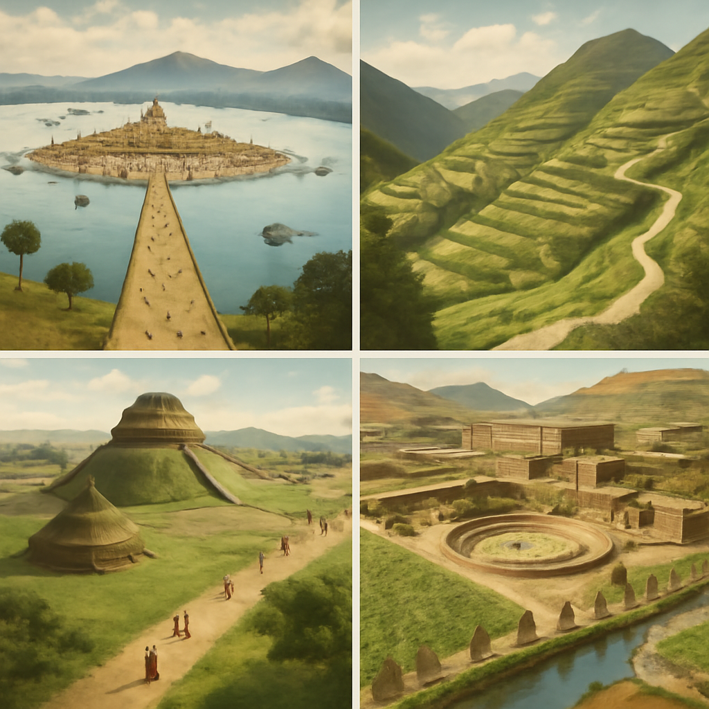
Start with four grounded cases. Cahokia's mound-and-plaza landscape suggests maize surplus, seasonal gathering, labor coordination, ritual authority, and regional ties near the Mississippi. Chaco's great houses, great kivas, roads, turquoise exchange, and debated astronomical alignments point to ceremony and exchange rather than one simple capital. Tenochtitlan's market, causeways, chinampa farming, and lake defenses show Mexica urban power at water scale. The Pueblo Revolt of 1680 shows coordinated resistance through villages, messengers, ritual leadership, and Spanish colonial pressure, not disappearance.
This atlas page has not received a separate Indigenous community review for this article. It therefore relies on published resources shaped by Native scholars, educators, or community consultation where possible: Smithsonian Native Knowledge 360, the NMAI Haudenosaunee guide, Indigenous Chicago, and named scholarship such as Ned Blackhawk's work. That limitation is part of the source frame, not a footnote hidden from readers.
Micro-scenes keep the route human: a Maya scribe setting a date into dynastic memory, a Cahokia worker carrying basket loads of earth toward a mound, a Mexica market official tracking tribute goods in Tlatelolco, a Chaco traveler moving between great houses, a Pueblo messenger carrying revolt coordination, and Haudenosaunee educators explaining continuity through political memory.
Each region has its own source problem. UNESCO can anchor Cahokia and Nazca as archaeological landscapes; colonial chronicles help with Aztec, Inca, and early contact events but filter Indigenous voices through conquest; oral history and descendant community knowledge preserve meanings that excavation alone cannot supply. The page treats those source types as complementary, not interchangeable.
Start With These Dates
- c. 1200 BCEOlmec Centers Flourish
Olmec centers on the Gulf Coast developed monumental sculpture, ritual landscapes, and elite authority that influenced later Mesoamerican societies.
- c. 900 BCEChavin Culture Flourishes
Chavin de Huantar became a major Andean ceremonial center, linking ritual practice, art, pilgrimage, and highland exchange.
- c. 500 BCEMonte Alban Founded
Zapotec leaders developed Monte Alban on a hilltop above the Oaxaca Valley, creating one of Mesoamerica's earliest major urban centers.
- c. 200 BCE-600 CENazca Lines Created
Nazca communities created large geoglyphs in the desert, turning landscape, movement, ritual, and visibility into historical evidence.
- 1428Aztec Triple Alliance Forms
Tenochtitlan, Texcoco, and Tlacopan formed the Triple Alliance, creating the political structure behind Aztec imperial expansion.
- July 2, 1964Civil Rights Act of 1964
The United States enacted major civil rights legislation banning discrimination in public accommodations, employment, and federally funded programs.
- 1994Zapatista Uprising
The Zapatista uprising in Chiapas challenged Mexican state power, Indigenous marginalization, land inequality, and neoliberal globalization.
- 2015Small Island States Push the Paris Agreement
Small island states, including Pacific voices, pushed climate diplomacy toward recognizing survival, sea-level rise, and the 1.5 degree goal.
Sources Used Here
- Smithsonian National Museum of the American Indian: Native Knowledge 360
Indigenous-centered educational reference for Native history, sovereignty, community knowledge, and public interpretation.
- Smithsonian NMAI: Haudenosaunee Guide for Educators
Community-consulted educational reference for Haudenosaunee culture, history, continuity, and interpretation.
- Yale History: Ned Blackhawk, The Rediscovery of America
Indigenous historian's synthesis for centering Native peoples in broader American historical interpretation.
- Indigenous Chicago
Community-partnered public-history project for place-based Native history, maps, memory, and continuity.
- Encyclopaedia Britannica: Pre-Columbian civilizations
Reference for pre-Columbian civilizations in Mesoamerica and the Andes before European conquest.
No single Indigenous experience can carry the whole route. Maya scribes, Mexica market officials, Pueblo communities, Mississippian mound builders, Haudenosaunee diplomats, Mapuche fighters, Andean road communities, and Taino households had different languages, institutions, ecologies, and memories. The page names those differences before it turns to 1492, conquest, disease, missionization, legal survival, and continuing rights claims.
The rights layer enters later and is clearly signposted. Pueblo Revolt, Mapuche resistance, Zapatista organizing, museum interpretation, legal claims, and public-history projects belong to the history of survival and sovereignty, but the page does not retroactively turn every ancient society into a modern rights campaign. First it describes distinct communities and evidence; then it shows how conquest, law, memory, and political claims changed the frame.
The contested parts are named rather than smoothed over. Archaeology can date a plaza or road more easily than a political motive; oral history and descendant community memory can preserve place-based meanings that excavation alone cannot supply; Spanish records can reveal violence and administration while also filtering Indigenous voices. Reading the route well means asking which source type is speaking at each moment.
This timeline begins before 1492 because American history is not a European-arrival story with a short prologue. Olmec centers, Chavin, Monte Alban, Nazca, Teotihuacan, Maya city-states, Tiwanaku, Cahokia, Chaco, Tenochtitlan, and the Inca Empire reveal long histories of city-building, ritual landscapes, agriculture, trade, writing, astronomy, roads, labor, and political authority.
The first chapter asks how people made power visible in different environments. Gulf Coast centers used monumental sculpture and ritual space. Andean communities used highland pilgrimage, geoglyphs, roads, and storehouses. Cahokia and Chaco organized plazas, mounds, great houses, and regional roads. These are not incomplete versions of the same system; they are different answers to geography, authority, and memory.
The conquest chapter changes the scale without erasing earlier complexity. The fall of the Aztec and Inca empires involved disease, Spanish violence, Indigenous allies, internal conflict, translation, religion, tribute, labor, and local strategy. Reading conquest after a long Indigenous route makes it harder to imagine Europeans as the only historical actors.
The final chapter follows survival and renewed political claim-making. Pueblo Revolt and the Zapatista uprising show that Indigenous history did not end with conquest or colonial administration. Land, language, ritual, autonomy, and public memory remain active historical forces. This gives the timeline a living afterlife instead of a closed ancient-world ending.
The route also teaches evidence. Archaeology, inscriptions, geoglyphs, colonial chronicles, oral memory, ecological data, and modern community claims do not preserve the same voices. The page becomes stronger when readers ask which evidence speaks clearly, which has been filtered through conquest, and which communities continue to interpret the past.
The reading path intentionally crosses familiar school categories. A reader may arrive looking for the Aztec Empire, but the route also opens toward Teotihuacan, Maya city-states, Cahokia, Chaco, Andean roads, and Pueblo resistance. That breadth matters because it prevents a single conquest narrative from swallowing the diversity of Indigenous American history.
The map layer is equally important. Lake basins, highland valleys, coastal deserts, river corridors, plazas, causeways, terraces, and roads gave societies different tools for gathering food, labor, tribute, pilgrims, and information. The timeline therefore asks readers to connect each date to a landscape instead of memorizing isolated names.
A useful reading sequence starts with cities and landscapes, then moves to empire, conquest, revolt, and continuity. That order changes the emotional shape of the page. Instead of treating Indigenous societies as background for European expansion, the timeline makes conquest one chapter inside a longer history of political imagination, adaptation, and survival.
This route starts from Indigenous time, not from European arrival. Olmec centers, Chavin, Monte Alban, Nazca, Teotihuacan, Maya cities, Tiwanaku, Cahokia, Chaco, Tenochtitlan, and Cusco show that the Americas contained many political forms before conquest: ritual centers, pilgrimage landscapes, city-states, road systems, mound complexes, lake capitals, and highland empires. The chronology becomes richer when 1492 appears as a rupture inside an already long history.
Environment is not background here. Gulf Coast lowlands, highland valleys, desert geoglyphs, lake basins, Mississippi floodplains, canyon roads, Andean terraces, and tropical trade corridors shaped how authority could be gathered and displayed. The route asks readers to see plazas, mounds, causeways, temples, fields, storehouses, and roads as political technology. Power did not look the same in Teotihuacan, Cahokia, Chaco, Tenochtitlan, and the Andes.
The evidence changes from node to node. Archaeology can show settlement, diet, trade, monuments, tools, and landscape engineering. Inscriptions can preserve elite names and ritual sequences. Colonial chronicles can preserve detail while filtering it through conquest. Oral memory and modern community claims carry other forms of continuity. A stronger page tells readers when the archive is material, written, colonial, or living.
The conquest chapter becomes more accurate when it follows Indigenous strategy as well as Spanish violence. The fall of the Aztec and Inca empires involved disease, horses, steel, guns, translation, Christian claims, tribute pressure, civil war, rival polities, and Indigenous allies who made their own calculations. That complexity does not reduce brutality. It explains why small invading forces could only act through local fractures and epidemic shock.
Continuity is the final frame. Pueblo Revolt and the Zapatista uprising keep the timeline from closing with imperial defeat. They return the reader to land, ritual, autonomy, language, municipal power, public memory, and the question of who gets to interpret the past. Indigenous history continues through legal claims, community education, archaeology, museum debates, ecological knowledge, and political movements.
The route also invites comparison without flattening difference. A Maya city-state, an Inca road system, a Mississippian mound center, and a Pueblo revolt all answer problems of authority, food, labor, ritual, and memory in distinct ways. Comparison is useful when it reveals variety rather than forcing every society into the same ladder of development.
A beginner route can follow Olmec, Teotihuacan, Maya cities, Cahokia, Tenochtitlan, the Inca, conquest, Pueblo Revolt, and Zapatistas. A deeper route adds Chavin, Monte Alban, Nazca, Tiwanaku, Chaco, Pachacuti, the Columbian Exchange, and modern rights pages. The route is wide because one famous empire cannot stand in for the Indigenous Americas.
The page's emotional center is not loss alone. It includes invention, beauty, statecraft, agriculture, mathematics, astronomy, urban planning, labor systems, warfare, alliance, recovery, and refusal. Conquest remains a decisive rupture, but it does not get to define every earlier or later page. The stronger reading gives Indigenous societies historical depth before, during, and after European empire.
The story is strongest when read in layers. First, follow the dates from c. 1200 BCE to 2015. Then read across the event types: urban and ritual development, religious and cultural network, city foundation, landscape and ritual construction. The timeline becomes more than chronology when those dates reveal decisions, institutions, violence, reform, and memory.
Aztec Triple Alliance Forms sits near the middle of the sequence. Ask what had already become unavoidable by 1428, what actors still believed they could control, and which consequences were already beginning to move beyond the original setting.
The named events are Olmec Centers Flourish, Chavin Culture Flourishes, Monte Alban Founded, Nazca Lines Created, Teotihuacan Reaches Its Urban Peak, Classic Maya City-States Peak. Each one pushes a more precise question: what changed, who benefited, who paid the cost, and what later page explains the aftermath more clearly?
Read the timeline against geography too. Places matter because power moves through routes, borders, cities, ports, capitals, and frontiers. The map below keeps those distances visible while the event pages explain the human and institutional consequences.
A good timeline has a pulse: pressure, decision, expansion, resistance, and aftermath. When you move through Pre-Columbian Americas and Classic Mesoamerica, keep asking whether an event is creating a new problem, revealing a hidden weakness, or making an earlier choice harder to reverse.
The human layer matters because timelines can become too abstract. Figures such as Olmec sculptors, Gulf Coast communities, Andean ritual specialists, Highland communities, Zapotec rulers, Oaxaca Valley communities, and Nazca communities help the sequence feel lived rather than mechanical. Their choices do not explain everything, but they show where institutions, ideas, military systems, social movements, and public fear entered real decisions.
The ending is not only the last date. With closing events such as Brown v. Board of Education, Civil Rights Act of 1964, Zapatista Uprising, and Small Island States Push the Paris Agreement, the reader can ask what remained unsettled: which institutions survived, which arguments continued, which victims or opponents were left outside the official story, and which later crisis reused the same vocabulary.
Read this page once quickly for order, then read it again for contrast. Compare early confidence with later uncertainty, local decisions with global consequences, and visible turning points with slower changes in law, economy, belief, technology, borders, or memory. That second pass is where a timeline becomes an explanation.
Causation on this route is layered. One event may supply the trigger, another may reveal an older weakness, and a later event may show the consequence that people at the beginning did not expect. The useful habit is to separate background pressure, immediate decision, turning point, and aftermath before deciding which event matters most.
Consequences are uneven. A political settlement might look successful in one capital while creating resentment elsewhere; a military victory might end a campaign while deepening civilian trauma; a scientific or institutional breakthrough might solve one problem while creating new risks. The timeline is strongest when those mixed outcomes remain visible.
The final pass is comparative. After reading this sequence, open a neighboring topic or person page and ask whether the same pattern appears again. Repetition usually points to a structure; contrast usually points to a historical choice that could have gone another way.
Importance is not the same thing as drama. Some events are remembered because they were spectacular, while others matter because they changed rules, expectations, alliances, legal categories, technologies, or public language. Use the timeline to test both kinds of importance before deciding what belongs at the center of the story.
The page rewards moving outward. A timeline gives order, but the event pages give causes, maps, people, sources, and reading paths. When a date feels too compressed, open the full event page and then return here; the sequence becomes clearer with each pass instead of asking the reader to memorize a list.
Read Nazca, Chaco, the Andes, and Lake Texcoco as environments that shaped power.
Separate Spanish violence from Indigenous alliances, disease, local conflict, and imperial vulnerability.
Follow Pueblo and Zapatista pages as reminders that Indigenous political history continues.
Read plazas, mounds, canals, terraces, roads, causeways, deserts, lake basins, and highlands as evidence for political imagination.
Notice when knowledge comes from archaeology, inscription, architecture, colonial writing, oral memory, or modern community interpretation.
For a fast route, follow Teotihuacan, Maya cities, Cahokia, Tenochtitlan, Inca expansion, conquest, Pueblo Revolt, and Zapatistas.
Olmec Centers Flourish gives the opening problem a date and place. Ask what was already unstable before it happened.
Aztec Triple Alliance Forms is a compression point: earlier causes are now crowded together with decisions that will shape the route's ending.
Follow the route through San Lorenzo and Gulf Coast lowlands, Chavin de Huantar, Monte Alban, Nazca Desert, Teotihuacan, and Maya lowlands and ask how distance changed communication, logistics, fear, and control.
Small Island States Push the Paris Agreement works as both an ending and a beginning: it closes one sequence while opening later disputes, institutions, memories, or reforms.
Which conditions existed before the first event, and which later decision turned those conditions into visible historical change?
Who had the power to choose, who had fewer choices, and who is missing when the story is told only through leaders or institutions?
Which facts are date anchors, which are interpretations, and which claims need checking through the event sources before being repeated?
Which linked event, person, year, or topic page would change your interpretation if you read it next?
Interactive Timeline
Explore Indigenous Americas and Pre-Columbian Civilizations Timeline by sequence
Olmec Centers Flourish
Olmec centers on the Gulf Coast developed monumental sculpture, ritual landscapes, and elite authority that influenced later Mesoamerican societies.
Read the full event pageNarrative Stages
Read this timeline in chapters
Early Centers and Ritual Landscapes
Olmec, Chavin, Monte Alban, Nazca, and Teotihuacan show early American political and ritual worlds built through monuments, cities, landscapes, and regional exchange.
- Olmec Centers Flourishc. 1200 BCE
- Chavin Culture Flourishesc. 900 BCE
- Monte Alban Foundedc. 500 BCE
- Nazca Lines Createdc. 200 BCE-600 CE
- Teotihuacan Reaches Its Urban Peakc. 450 CE
City-States, Roads, and Regional Power
Maya cities, Tiwanaku, Toltec Tula, Cahokia, Chaco, Tenochtitlan, and the Triple Alliance reveal several forms of urban and regional authority.
- Classic Maya City-States Peakc. 600 CE
- Tiwanaku State Expandsc. 700 CE
- Tula and Toltec Power Flourishc. 950 CE
- Cahokia Risesc. 1050 CE
- Pueblo Bonito Flourishesc. 1100 CE
- Tenochtitlan Founded1325
- Aztec Triple Alliance Forms1428
Empire and Conquest Crisis
Inca expansion, the Columbian Exchange, and the fall of the Aztec and Inca empires show conquest as epidemic, alliance, violence, and imperial stress.
- Inca Expansion under Pachacutic. 1438
- Columbian Exchange Begins1492 onward
- Fall of the Aztec Empire1521 CE
- Fall of the Inca Empire1533
Revolt and Modern Rights
Pueblo Revolt, Zapatistas, the Declaration of Independence, Haiti, Mexico, Brown v. Board, and civil rights connect Indigenous continuity with wider rights language.
- Pueblo Revolt1680
- Zapatista Uprising1994
- Declaration of IndependenceJuly 4, 1776
- Haitian Revolution Begins1791 CE
- Mexican Revolution Begins1910
- Brown v. Board of EducationMay 17, 1954
- Civil Rights Act of 1964July 2, 1964
Pacific and Climate Connections
Maori settlement and small-island climate diplomacy widen the route toward Indigenous sovereignty, ocean worlds, and modern environmental politics.
Map Layer
Indigenous Americas and Pre-Columbian Civilizations Timeline geography
Gold pins mark the approximate locations of published event pages. This is a schematic locator map, not a historical border map.
Event location Simplified land areaClick a pin to open the event page
Coordinates are approximate and are used to help readers orient themselves before opening a full event page.
References
Where to Check the Facts
- Smithsonian National Museum of the American Indian: Native Knowledge 360Indigenous-centered educational reference for Native history, sovereignty, community knowledge, and public interpretation.
- Smithsonian NMAI: Haudenosaunee Guide for EducatorsCommunity-consulted educational reference for Haudenosaunee culture, history, continuity, and interpretation.
- Yale History: Ned Blackhawk, The Rediscovery of AmericaIndigenous historian's synthesis for centering Native peoples in broader American historical interpretation.
- Indigenous ChicagoCommunity-partnered public-history project for place-based Native history, maps, memory, and continuity.
- Encyclopaedia Britannica: Pre-Columbian civilizationsReference for pre-Columbian civilizations in Mesoamerica and the Andes before European conquest.
- Official UNESCO World Heritage Centre: Cahokia Mounds State Historic SiteReference for Cahokia as a major pre-Columbian settlement north of Mexico.
- Encyclopaedia Britannica: Mesoamerican civilizationReference for Mesoamerican chronology, cities, religion, trade, and political systems.
- Encyclopaedia Britannica: AztecReference for Aztec political expansion, Tenochtitlan, and the Triple Alliance.
- Encyclopaedia Britannica: IncaReference for Inca state formation, expansion, and Spanish conquest.
- Official UNESCO World Heritage Centre: Lines and Geoglyphs of Nasca and PalpaReference for the Nazca geoglyph landscape and its archaeological significance.