Central Question
How can readers connect the Middle East, North Africa, and Islamic World without reducing the region to religion, empire, oil, or modern conflict alone?
Start With These Dates
- c. 10,000 BCENeolithic Farming Expands
Farming and settled village life expanded in parts of Southwest Asia, changing human relationships with plants, animals, labor, storage, risk, and landscape.
- 539 BCECyrus Conquers Babylon
Cyrus the Great captured Babylon, absorbing the Neo-Babylonian kingdom into the expanding Achaemenid Empire.
- 331 BCEBattle of Gaugamela
Alexander the Great defeated Darius III at Gaugamela, breaking Persian imperial power and opening the way to Macedonian control over the empire.
- c. 610 CEBeginning of Muhammad's Revelations
Islamic tradition places the first revelations to Muhammad near Mecca, beginning a religious movement that would transform Arabia and much of the wider world.
- 751 CEBattle of Talas
Tang and Abbasid forces fought near the Talas River as rival powers competed over Central Asian alliances, trade corridors, and frontier influence.
- November 17, 1869Opening of the Suez Canal
The Suez Canal opened a direct water route between the Mediterranean and Red Sea, shortening sea travel between Europe and Asia.
- December 2010Arab Spring Begins
Protests in Tunisia spread into a wider regional wave against authoritarian rule, corruption, unemployment, and police abuse.
Sources Used Here
- Encyclopaedia Britannica: History of the Middle East
Reference for the region's ancient, Islamic, Ottoman, colonial, and modern historical layers.
- The Metropolitan Museum of Art: The Islamic World
Reference for Islamic-world cultural geography, trade, dynasties, and material history.
Middle East, North Africa, and Islamic World is designed as a route, not a folder. It gathers events that answer related reader questions about power, belief, conflict, exchange, institutions, and memory. The strongest way to read the page is to move from the earliest events toward the later ones, watching how one kind of pressure changes form across different places.
The route currently runs from c. 10,000 BCE to December 2010. That span lets readers compare immediate turning points with slower consequences: the founding of institutions, the spread of ideas, the shock of war or disease, and the way later societies reused earlier events as warnings, models, or symbols.
Start with Neolithic Farming Expands, Cyrus Conquers Babylon, Battle of Gaugamela, Beginning of Muhammad's Revelations, Hijra to Medina and then follow the internal links into people, timelines, years, maps, and source lists. The route structure stays visible when each event explains why it belongs with the others and where the next useful page is.
Compare the events by scale. Some are concentrated moments, such as a battle, proclamation, trial, or publication. Others are long processes, such as a reform movement, pandemic, trade route, or diplomatic order. Reading both types together helps prevent the page from becoming a list of dates.
A useful route keeps uncertainty visible. Historical change rarely has one cause or one clean ending, so the reader can separate background pressure, immediate trigger, turning point, result, and later memory. That pattern is what makes the atlas expandable without making the reader start over each time.
This route is also a comparison tool. After reading one event, compare it with a later event on the same page and ask what changed in scale, language, geography, technology, authority, or public memory. The comparison is often more useful than the individual summary because it reveals the pattern the topic page is built to expose. When a claim feels too neat, open the full event page and check whether the evidence supports one cause, several causes, or a contested interpretation before moving on.
Middle East, North Africa, and Islamic World is a deliberately broad V2-B hub because the atlas needs one route that connects ancient Southwest Asia, Persian and Hellenistic empires, Arabia, caliphates, Baghdad, pilgrimage, Ottoman power, Suez, colonial borders, oil-era politics, and modern uprisings. The route does not claim that religion explains everything. It asks how geography, cities, revelation, law, trade, empire, and memory interacted across a huge region.
The first layer is deep settlement and empire. Neolithic farming, Babylon, Persia, and Gaugamela remind readers that the region was not born with Islam or with modern borders. River valleys, highlands, deserts, caravan routes, ports, and imperial capitals shaped political imagination long before the seventh century. Ancient and classical material matters because later rulers and communities inherited older cities, languages, routes, and symbols.
The rise of Islam gives the route its central transformation. Muhammad's revelations, the Hijra, and Badr show community formation, migration, conflict, law, memory, and leadership in Arabia. The hub treats these events as religious and political history together. A community had to define belonging, authority, revelation, survival, and relations with neighboring groups under pressure.
Caliphal expansion and Abbasid Baghdad widen the map. Talas and Baghdad show Islamic-world history as Eurasian, not only Arabian. Paper, translation, merchants, scholars, soldiers, tax systems, urban life, and frontier diplomacy all mattered. The Islamic World became a set of connected centers rather than a single place. That distinction prevents the route from flattening diverse societies into one religious label.
North Africa belongs inside the same route but not as a footnote. Mediterranean cities, Sahara crossings, Fatimid, Almohad, Ottoman, Arab, Berber, Amazigh, Jewish, Christian, and Islamic histories need more future pages. Mansa Musa's hajj is useful here because it connects West Africa, Egypt, Mecca, gold, scholarship, pilgrimage, and global imagination. It shows that Islamic history is also African history.
The Ottoman and post-1453 layer changes the hub again. The fall of Constantinople was not only the end of Byzantium; it made the city an Ottoman capital and a hinge between Mediterranean, Balkan, Anatolian, Black Sea, and Islamic-world politics. Reading it through this hub prevents the event from being only a European tragedy or only an Ottoman triumph.
Suez creates a modern geography of pressure. The canal made shipping faster while intensifying imperial competition, finance, military strategy, and Egyptian politics. It also shows why infrastructure can become sovereignty. A canal, port, pipeline, or strait is not neutral when empires, companies, and states argue over who controls movement.
Modern borders and uprisings need careful treatment. Colonial mandates, nationalism, oil, military rule, Palestine and Israel, coups, migration, authoritarianism, foreign intervention, and protest all belong to later expansion. The Arab Spring page is a first contemporary anchor because it ties youth politics, social media, state violence, economic frustration, dignity claims, and regional contagion into one moment.
Evidence across the hub is uneven and multilingual. Sacred texts, hadith, chronicles, inscriptions, coins, travel accounts, court records, maps, colonial archives, newspapers, oral memory, and modern media all require different reading habits. The page teaches readers to distinguish faith claims, political narratives, administrative records, and later memory without reducing any of them to a simple source problem.
The hub also names a common trap: treating the region as permanently violent or timelessly religious. Many conflicts are modern, institutional, imperial, economic, environmental, or geopolitical even when religious language appears in them. Likewise, many religious histories are scholarly, legal, devotional, artistic, commercial, and social rather than military. The route has to resist both romantic and crisis-only pictures.
North Africa and the eastern Mediterranean require more balance in later batches. Egypt, the Maghreb, Amazigh histories, Ottoman provinces, French and British colonialism, Palestine, Israel, Lebanon, Algeria, Iran, the Gulf, and migration all need dedicated routes. This V2-B hub creates the shelf where those pages can belong without pretending one page can contain them.
Oil and infrastructure are future priorities because they connect the region to the contemporary world. Pipelines, shipping lanes, Suez, the Gulf, labor migration, state budgets, foreign policy, and environmental risk all show how resource history became global history. Adding those pages later will make the hub stronger for readers who arrive through modern politics.
The hub also makes minority and borderland histories visible. Jewish, Christian, Druze, Yazidi, Kurdish, Amazigh, Armenian, Coptic, Nubian, Persian, Arab, Turkish, and many other communities complicate any single story. Empires, states, and nationalist movements often tried to simplify this diversity, but history becomes clearer when the map keeps it visible.
Law and learning are as important as conquest. Madrasas, courts, jurists, libraries, translation circles, waqf endowments, markets, and pilgrimage institutions helped organize social life over distance. These structures explain durability in ways that battlefield narratives cannot. They also connect the hub to science, trade, religion, and urban history pages elsewhere in the atlas.
Environmental constraints matter too. Deserts, rivers, oases, ports, drought, irrigation, grain supply, and pastoral routes shaped settlement and state power. Modern water politics and climate stress are not separate from the older geography of river valleys, steppe edges, and caravan worlds. The page keeps that environmental line open for later expansion.
A careful reading path moves from city to route to institution. Mecca, Medina, Baghdad, Cairo, Constantinople, Suez, and modern protest squares each reveal a different kind of authority. Some organize pilgrimage, some scholarship, some empire, some shipping, and some public dissent. The map becomes an argument, not an illustration.
The Maghreb gives the route a western Mediterranean face. Morocco, Algeria, Tunisia, Libya, and wider Amazigh histories connect Roman Africa, Islamic expansion, trans-Saharan routes, Ottoman provinces, piracy and naval diplomacy, French and Italian colonialism, independence wars, labor migration, and memory politics. Without this layer, North Africa becomes either Egypt alone or a passage to somewhere else.
Egypt has to be read at several scales. Ancient river history, Islamic Cairo, Ottoman administration, Muhammad Ali's state-building, British occupation, Suez, Nasserism, the Arab-Israeli conflict, and the Arab Spring all pass through the same geographic hinge. The Nile, Mediterranean, Red Sea, canal, and desert routes make Egypt a test case for how infrastructure and state ambition can shape a region beyond its borders.
Iran and Persianate history widen the frame beyond Arabic language. Achaemenid memory, Sasanian rivalry, Persian literature, Shi'i institutions, Safavid state formation, Qajar and Pahlavi reform, oil politics, revolution, and regional diplomacy all complicate a simple Arab-centered map. The route becomes stronger when Persian, Turkish, Arabic, Kurdish, Armenian, and Amazigh stories are allowed to intersect without becoming identical.
Palestine and Israel require careful future treatment because sacred geography, Ottoman land, British mandate politics, Zionism, Palestinian nationalism, war, displacement, occupation, diplomacy, and memory all carry high stakes. The hub can name that structure without flattening it into a slogan. Readers need pages that separate chronology, law, lived experience, and later claims while keeping human consequences visible.
Oil changed the modern region by turning geology into state capacity and global dependency. Gulf monarchies, labor migration, U.S. security policy, OPEC, nationalization, sanctions, pipelines, tanker routes, and price shocks made local resource politics global. Oil also reshaped cities, citizenship, migrant labor, public budgets, and foreign policy. It belongs beside Suez because both show movement as power.
Urban history gives the route texture below empire. Baghdad, Damascus, Cairo, Fez, Tunis, Jerusalem, Istanbul, Tehran, Beirut, Alexandria, Algiers, Mecca, Medina, and Gulf cities each organize scholarship, commerce, pilgrimage, diplomacy, protest, or memory differently. A city lens lets readers see markets, neighborhoods, schools, shrines, ports, coffeehouses, newspapers, and prisons as historical spaces.
Ordinary life prevents the route from becoming only states and wars. Farmers managing irrigation, pastoralists crossing seasonal routes, pilgrims saving for travel, scribes copying documents, merchants negotiating credit, women sustaining households, migrants sending remittances, students joining protests, and refugees rebuilding community all show how large structures become lived history. This layer gives readers a reason to keep reading after the famous events.
The strongest next expansion ladder is ancient Southwest Asia; early Islam and caliphates; North African and Persianate routes; Ottoman and Safavid statecraft; colonial mandates and nationalist movements; oil and infrastructure; Palestine and Israel; modern protest, war, migration, and climate stress. That ladder can keep the hub broad without letting any single crisis define the whole region.
Food and agriculture make the geography less abstract. Wheat, barley, dates, olives, coffee, sugar, cotton, citrus, irrigation canals, pastoral herds, and grain imports connect households to empire and world markets. Famine, subsidy, bread prices, and water scarcity can become political questions when states lose the ability to promise basic stability. The region is easier to understand when food stands beside oil and war.
Pilgrimage adds another route of movement. Hajj, shrine visitation, caravan protection, steamship travel, passports, railways, and modern aviation made sacred geography part of logistics and state authority. Pilgrimage could connect communities, circulate knowledge, spread reform ideas, and expose travelers to imperial surveillance. It shows that mobility in this region is not only military or commercial.
Education and print changed modern politics. Mission schools, madrasas, universities, newspapers, pamphlets, radio, television, satellite channels, and social media all created publics that could argue over reform, nationalism, religion, feminism, labor, and authoritarian rule. A protest square is easier to read when readers know how ideas traveled before the crowd assembled.
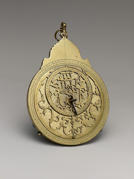
The visual path can improve later with more place-specific images: Cairo streets, Ottoman documents, North African manuscripts, Suez maps, oil infrastructure, refugee archives, and protest photographs. The current astrolabe works as a knowledge-and-navigation object, but promotion-quality coverage will eventually need a broader image library so modern, ancient, North African, Persian, and Gulf pages do not all borrow one symbol.
Memory politics keeps the modern route unsettled. Colonial archives, war memorials, exile testimony, martyr posters, museum labels, schoolbooks, and social media all turn the past into present argument. Competing memories do not make evidence useless; they make source discipline more necessary.
The route also benefits from borderland reading. Sinai, Kurdistan, the Sahara, the Gulf, the Levant, the Nile Valley, and the Caucasus show that state borders rarely contain older languages, trade routes, kinship, pilgrimage, or refugee movement. Borderlands keep the map honest.
The next pages should be chosen for missing structure: one North African colonial route, one Persianate state route, one Palestine-Israel chronology, one oil-and-labor route, and one water or climate route would make the hub much less dependent on a few famous crises.
That mix would also give readers clearer choices by region, period, source type, chronology, and problem.
It would make the route easier to scan without making the history smaller.
The reader payoff is a route that opens many doors without collapsing them into one story. A student can begin with Islam, but the page points backward to ancient Southwest Asia, sideways to Africa and Central Asia, forward to Ottoman and colonial histories, and outward to trade, law, pilgrimage, oil, war, and protest. That structure gives Google and readers a clear hub while leaving room for separate future pages.
Read the events in order first; the page is built to reveal change over time.
Ask which pressures existed before the visible turning point and which actors had room to choose.
Follow what changed afterward in institutions, borders, law, belief, or everyday life.
Notice which events became symbols and why later generations kept returning to them.
Start with rivers, deserts, cities, empires, and routes before reading nation-state borders backward into the past.
Treat Islam as a connected religious and institutional world, not as one culture or one political system.
Watch canals, ports, caravan routes, pilgrimage roads, and oil corridors as sites of power.
Separate sacred memory, court history, colonial records, archaeology, and contemporary media.
Keep Amazigh, Egyptian, Maghrebi, Persianate, Turkish, Arab, Armenian, Kurdish, Jewish, and Coptic histories visible.
Read canals, rivers, pipelines, ports, irrigation, drought, and energy markets as political structures.
Choose a Reading Path
Start With the Timeline
Use the related timeline first when you want a chronological route through the topic.
Start with c. 10,000 BCE: Neolithic Farming ExpandsOpen a Person Page
Use people pages when the topic is easier to understand through leadership, resistance, reform, or memory.
Start with 539 BCE: Cyrus Conquers BabylonUse Year Pages
Use year pages when you need a fast answer to what changed in a specific year.
Start with 331 BCE: Battle of GaugamelaReturn to the Map
Use the map to keep geography visible while moving between events and regions.
Start with c. 610 CE: Beginning of Muhammad's RevelationsAncient Route
Use farming, Babylon, Persia, and Gaugamela to place the region before Islam and modern borders.
Start with 751 CE: Battle of TalasEarly Islam Route
Follow revelation, Hijra, Badr, Talas, and Baghdad for community formation and caliphal scale.
Start with November 17, 1869: Opening of the Suez CanalAfrican and Oceanic Route
Read Mansa Musa, Suez, and trade pages to connect North Africa, West Africa, pilgrimage, and shipping.
Start with December 2010: Arab Spring BeginsModern Crisis Route
Use Suez and Arab Spring as entry points into sovereignty, protest, intervention, and contested memory.
North Africa Route
Move through Egypt, the Maghreb, Amazigh histories, French colonialism, and independence wars to widen the map westward.
Oil and Border Route
Use Gulf oil, Palestine and Israel, Iran, pipelines, sanctions, and migration when the question is modern power.
How the Story Builds
Begin with Neolithic Farming Expands. The opening event usually shows the pressure that made the route necessary: a crisis of authority, an expanding exchange system, a new technology, a contested idea, or a conflict that older institutions could no longer contain.
Battle of Talas works as a checkpoint because it lets readers ask what had become irreversible, which actors still had choices, and how the route changed scale between the opening event and the later consequences.
The later edge of the route includes Safavid Empire Founded, Opening of the Suez Canal, and Arab Spring Begins. These pages help readers see what survived beyond the first shock: institutions, borders, laws, memories, technologies, movements, or arguments that kept shaping later history.
The route is easier to remember through people and places. Watch figures such as early farming communities, Cyrus the Great, Nabonidus, Alexander the Great, Darius III, and Muhammad move through settings such as Fertile Crescent, Babylon, Gaugamela, Mecca, and Medina; that is where large structures become visible as choices, risks, costs, and memories.
Agriculture, Mesopotamia, Persia, and Hellenistic conquest establish older cities, routes, and imperial habits.
Revelation, migration, battle, law, and expansion turn early Islam into a historical force.
Baghdad, translation, trade, paper, and scholarship make the Islamic World a network of centers.
Constantinople and Suez reveal how capitals and infrastructure reorder regional and global power.
Arab Spring points toward borders, protest, oil politics, media, and state violence that future pages must deepen.
French, British, Italian, Ottoman, and local institutions shaped borders, armies, property, schools, and later nationalist claims.
Oil, labor migration, refugees, water politics, sanctions, and ports connect regional histories to global systems.
- Which event in Middle East, North Africa, and Islamic World feels like the true point of no return, and why might another reader choose a different event?
- What changes if the route is read from the perspective of ordinary people rather than rulers, armies, inventors, reformers, or institutions?
- Which consequence was immediate, and which consequence only became clear decades later?
- Where does the map change the interpretation by showing distance, borders, routes, ports, capitals, or frontiers?
- How can this route connect MENA and the Islamic World without making them identical?
- Why do cities such as Mecca, Medina, Baghdad, Cairo, and Constantinople matter differently?
- What changes when Suez is read as sovereignty rather than engineering alone?
- Which sources help distinguish religious memory from administrative history?
- Which future pages are needed for Ottoman, Safavid, Mughal, Palestine, oil, and North African histories?
- How does the route change when North Africa and Persianate histories stand beside Arabic and Ottoman histories?
- Why do water, oil, pipelines, ports, and labor migration belong inside political history?
Interactive Timeline
Follow Middle East, North Africa, and Islamic World by sequence
Neolithic Farming Expands
Farming and settled village life expanded in parts of Southwest Asia, changing human relationships with plants, animals, labor, storage, risk, and landscape.
Read the full event pageMap Layer
Middle East, North Africa, and Islamic World geography
Gold pins mark the approximate locations of published event pages. This is a schematic locator map, not a historical border map.
Coordinates are approximate and are used to help readers orient themselves before opening a full event page.
Route Events
Events in This Topic
Neolithic Farming Expands
Farming and settled village life expanded in parts of Southwest Asia, changing human relationships with plants, animals, labor, storage, risk, and landscape.
Cyrus Conquers Babylon
Cyrus the Great captured Babylon, absorbing the Neo-Babylonian kingdom into the expanding Achaemenid Empire.
Battle of Gaugamela
Alexander the Great defeated Darius III at Gaugamela, breaking Persian imperial power and opening the way to Macedonian control over the empire.
Beginning of Muhammad's Revelations
Islamic tradition places the first revelations to Muhammad near Mecca, beginning a religious movement that would transform Arabia and much of the wider world.
Hijra to Medina
Muhammad and his followers migrated from Mecca to Medina, creating a new community that linked religious authority with social and political organization.
Battle of Badr
The early Muslim community fought Meccan opponents at Badr, a battle remembered in Islamic tradition as a decisive moment of communal survival.
Battle of Talas
Tang and Abbasid forces fought near the Talas River as rival powers competed over Central Asian alliances, trade corridors, and frontier influence.
Mongol Sack of Baghdad
Mongol forces under Hulagu captured Baghdad, ending the Abbasid caliphate's political center and shocking the Islamic world.
Mansa Musa's Hajj
Mansa Musa's pilgrimage to Mecca displayed Mali's wealth, Islamic connections, and diplomatic visibility across North Africa and the wider Muslim world.
Fall of Constantinople
Ottoman forces under Mehmed II captured Constantinople after a sustained siege, ending the Byzantine Empire and making the city a central capital of Ottoman power.
Safavid Empire Founded
Ismail I founded the Safavid dynasty in Iran, creating a major early modern Islamic empire and making Twelver Shi'ism central to state identity.
Opening of the Suez Canal
The Suez Canal opened a direct water route between the Mediterranean and Red Sea, shortening sea travel between Europe and Asia.
Arab Spring Begins
Protests in Tunisia spread into a wider regional wave against authoritarian rule, corruption, unemployment, and police abuse.
References
Where to Check the Facts
- Encyclopaedia Britannica: History of the Middle EastReference for the region's ancient, Islamic, Ottoman, colonial, and modern historical layers.
- The Metropolitan Museum of Art: The Islamic WorldReference for Islamic-world cultural geography, trade, dynasties, and material history.