Central Question
How does South Asian history change when empire, religion, trade, caste, colonial rule, and partition are read as one long regional route?
Start With These Dates
- c. 10,000 BCENeolithic Farming Expands
Farming and settled village life expanded in parts of Southwest Asia, changing human relationships with plants, animals, labor, storage, risk, and landscape.
- c. 322 BCEMauryan Empire Founded
Chandragupta Maurya founded the Mauryan Empire, creating one of South Asia's largest early imperial states after the decline of older kingdoms.
- c. 260 BCEAshoka Turns Toward Buddhism
After the Kalinga War, Ashoka promoted Buddhist ethics and imperial moral rule through inscriptions and public policy.
- c. 30 CEKushan Empire Rises
The Kushan ruling line emerged from Yuezhi groups in Bactria and built a state linking Central Asia, northern India, and long-distance trade routes.
- c. 320 CEGupta Empire Rises
The Gupta dynasty rose in northern India, building a durable imperial order from the Ganges heartland.
- March-April 1930Salt March
Mahatma Gandhi led a march to the sea to protest Britain's salt monopoly, turning a common commodity into a symbol of colonial resistance.
- August 1947Indian Independence and Partition
British India became independent as India and Pakistan, while partition produced mass migration, communal violence, and unresolved border questions.
Sources Used Here
- Encyclopaedia Britannica: History of India
Reference for South Asian chronology from early states through colonial rule and independence.
- The Metropolitan Museum of Art: South Asia timeline essays
Reference for South Asian art, political history, religion, and regional periodization.
South Asia is designed as a route, not a folder. It gathers events that answer related reader questions about power, belief, conflict, exchange, institutions, and memory. The strongest way to read the page is to move from the earliest events toward the later ones, watching how one kind of pressure changes form across different places.
The route currently runs from c. 10,000 BCE to August 1947. That span lets readers compare immediate turning points with slower consequences: the founding of institutions, the spread of ideas, the shock of war or disease, and the way later societies reused earlier events as warnings, models, or symbols.
Start with Neolithic Farming Expands, Mauryan Empire Founded, Ashoka Turns Toward Buddhism, Kushan Empire Rises, Gupta Empire Rises and then follow the internal links into people, timelines, years, maps, and source lists. The route structure stays visible when each event explains why it belongs with the others and where the next useful page is.
Compare the events by scale. Some are concentrated moments, such as a battle, proclamation, trial, or publication. Others are long processes, such as a reform movement, pandemic, trade route, or diplomatic order. Reading both types together helps prevent the page from becoming a list of dates.
A useful route keeps uncertainty visible. Historical change rarely has one cause or one clean ending, so the reader can separate background pressure, immediate trigger, turning point, result, and later memory. That pattern is what makes the atlas expandable without making the reader start over each time.
This route is also a comparison tool. After reading one event, compare it with a later event on the same page and ask what changed in scale, language, geography, technology, authority, or public memory. The comparison is often more useful than the individual summary because it reveals the pattern the topic page is built to expose. When a claim feels too neat, open the full event page and check whether the evidence supports one cause, several causes, or a contested interpretation before moving on.
South Asia is one of the atlas routes where long continuity and violent rupture have to be held together. The hub begins with early farming and settlement, moves through Maurya, Ashoka, Kushan, Gupta, Indian Ocean contact, colonial pressure, Gandhi's Salt March, independence, and partition. This order helps readers see that South Asian history is not only a story of religion or empire. It is also a story of ecology, language, caste, trade, law, memory, and mass politics.
The early route starts with land and food. Neolithic farming does not make South Asia a simple copy of Southwest Asian history, but it opens the larger question of how cultivation, settlement, animal management, storage, and disease risk changed social life. South Asian regional diversity matters from the beginning. Rivers, monsoons, plains, coasts, highlands, and passes gave communities different possibilities.
The Maurya Empire gives the hub its first large political spine. Chandragupta's rise and Ashoka's later memory show state formation at a subcontinental scale: armies, taxation, roads, spies, court organization, inscriptions, provincial rule, and conquest. Ashoka matters because he forces readers to ask whether imperial power can speak about remorse and moral duty while still depending on the machinery of empire.
Kushan and Gupta pages widen the frame. Kushan power connects Central Asia, South Asia, coinage, trade, Buddhism, and Silk Road routes. Gupta memory points to court culture, Sanskrit learning, religious patronage, regional power, and later claims about a classical age. These pages prevent South Asia from appearing only through Maurya and British colonialism. They make the middle of the route visible.
Religion has to be read as lived institution and political language. Buddhism, Hindu traditions, Islam, Jain communities, Sikh history, devotional movements, and later reform all need more pages, but this hub begins the structure. Religious change happens through patronage, pilgrimage, monasteries, temples, courts, merchants, teachers, poets, reformers, and household practice. It is not only doctrine.
The Indian Ocean makes South Asia global before European conquest. Vasco da Gama's arrival belongs here because it entered existing trade worlds rather than discovering an empty route. Ports, spices, textiles, pilgrims, merchants, monsoon knowledge, Muslim trading communities, Portuguese violence, and later company power all belong to the same maritime problem: who controls movement and profit across the ocean?
Colonial rule changes the hub, but it should not be allowed to swallow it. British power worked through revenue systems, railways, law, racial hierarchy, soldiers, famine policy, education, census categories, and political negotiation. It also interacted with older institutions and new movements. South Asian nationalism was not one voice; it included moderates, radicals, revolutionaries, peasants, workers, religious organizations, princely states, and competing visions of sovereignty.
The Salt March is a strong entry point because it turns an everyday substance into a political instrument. Salt connected law, tax, bodies, labor, coastlines, media, discipline, and civil disobedience. The march helps readers understand how mass politics works: a symbolic act becomes powerful when it exposes an entire system of authority.
Independence and partition must be read together. 1947 created sovereign states while also producing displacement, violence, border-making, trauma, and competing memories. A thin page would treat independence as a happy ending. A richer South Asia route asks how liberation, partition, citizenship, refugee history, communal violence, and state formation became simultaneous.
Caste, class, gender, and language are essential next layers. They cannot be solved by a single event page, but the hub has to make room for them. Social hierarchy shaped access to land, labor, education, religious authority, political representation, and violence. Future pages on reform movements, Dalit politics, women's movements, linguistic states, and labor would make the route more honest.
The route also needs Pakistan, Bangladesh, Sri Lanka, Nepal, Afghanistan's South Asian links, and diaspora histories. Partition created India and Pakistan, while Bangladesh's later independence, Tamil politics, Himalayan states, Gulf migration, and global South Asian communities widened the map. A region hub helps readers see South Asia as more than India while still using Indian events that currently anchor the content.
Economic history also belongs here. Textile production, agrarian taxation, land revenue, railways, tea plantations, opium, famine policy, postcolonial planning, Green Revolution agriculture, software industries, and labor migration all changed the region's place in the world. South Asia cannot be understood only through kings, saints, and nationalist leaders; it also has to be read through work, land, money, and food.
The hub makes borderlands visible. The northwest connected South Asia to Central Asia and Iran; Bengal connected river, delta, ocean, and later partition histories; the Deccan, Tamil regions, Sri Lanka, and the Himalayan world each complicate any north Indian center. This is why future expansion needs place hubs, not only event pages.
A useful misconception to challenge is that South Asian history is either spiritual or colonial. The region has religious depth and colonial trauma, but also law, mathematics, trade, court culture, military organization, urban life, peasant politics, science, film, industry, and diaspora. The hub keeps those future routes open.
The strongest comparison inside the hub is between Ashoka and Gandhi. Both are remembered through moral language, but both operated inside hard political structures: empire, law, coercion, publicity, discipline, and mass communication. Reading them together helps students avoid turning South Asian history into a list of saints or rulers.
Partition also changes earlier history retrospectively. Once readers know how borders, religion, census categories, and political representation became violent in 1947, they can return to earlier empire and colonial pages with sharper questions about identity, administration, and who had authority to classify communities.
Evidence is varied: inscriptions, edicts, archaeology, Sanskrit and Pali texts, Persian chronicles, colonial censuses, legal records, nationalist newspapers, memoirs, photographs, oral histories, and migration testimony. Each source type highlights different actors. The hub therefore asks readers to notice when the record privileges rulers, monks, administrators, landlords, reformers, or refugees.
The Indus world is the largest missing early door, and the route names that gap because it changes how readers imagine South Asia before kingdoms and empires. Urban planning, seals, craft production, long-distance exchange, drainage, weights, and unresolved script questions would give the region an early city history that cannot be reduced to later religious or imperial categories. Until that layer is expanded, the farming and Maurya stages carry only part of the ancient story.
Language gives the region another structure. Sanskrit, Prakrits, Pali, Tamil, Persian, Arabic, Urdu, Bengali, Punjabi, Sinhala, Nepali, English, and many other languages carried poetry, law, administration, devotion, science, trade, and political claims. A South Asia route becomes richer when language is treated as infrastructure. It decides who can read a decree, join a court, sing a devotional poem, file a petition, or claim a nation.
Caste and social hierarchy need more than a warning label. They shaped access to land, ritual status, marriage, work, education, mobility, violence, and political representation across changing regimes. The topic gains depth when caste is read beside empire and reform, because rulers could exploit hierarchy, reformers could challenge it, and nationalist movements had to decide whether freedom meant political independence alone or social transformation as well.
The Delhi Sultanate and Mughal route belongs inside this regional story, even when it also has its own page. Persianate court culture, military households, land revenue, architecture, Sufi networks, trade, regional kingdoms, and debates over religious authority changed South Asian politics for centuries. Reading Delhi and Mughal history as a South Asian process prevents the route from jumping too quickly from Gupta memory to European company rule.
The British Empire did not govern one uniform society. Bengal, Punjab, Bombay, Madras, princely states, hill regions, tea plantations, port cities, and frontier zones met colonial law in different ways. Revenue settlements, courts, railways, education, census practices, and military recruitment created new categories while relying on older intermediaries. This variation explains why anti-colonial politics spread unevenly and why partition violence differed by region.
Food and famine belong at the center of the modern route. Monsoon failure, grain markets, export policy, railways, colonial priorities, wartime pressure, and relief systems shaped vulnerability. Famine history reveals the limits of treating infrastructure as progress by itself. A railway can move grain, but politics and prices decide who receives it. That question links economy, empire, and moral responsibility.
Gender changes the reading of both reform and partition. Debates over widow remarriage, education, property, purdah, nationalist symbolism, women in protest, sexual violence, abduction, refugee recovery, and household rebuilding all shaped modern South Asian history. The Salt March becomes more powerful when read through women who made civil disobedience visible in streets, kitchens, prisons, and local organizations.
Bangladesh and Sri Lanka need future depth because they show that postcolonial South Asia did not stop at 1947. Bengali language politics, Pakistan's federal crisis, the 1971 war, Tamil politics, Sinhala Buddhist nationalism, civil war, migration, and memory widen the map beyond India-Pakistan partition. The region route gives those histories a home while keeping their distinct causes visible.
Diaspora is another continuation rather than an appendix. Indentured labor after abolition, East African and Caribbean communities, Gulf migration, British South Asian politics, North American migration, remittances, caste and religion abroad, and digital family networks all show South Asia moving through the world after empire. The region's history therefore includes people who carried language, food, ritual, business, and political memory across oceans.
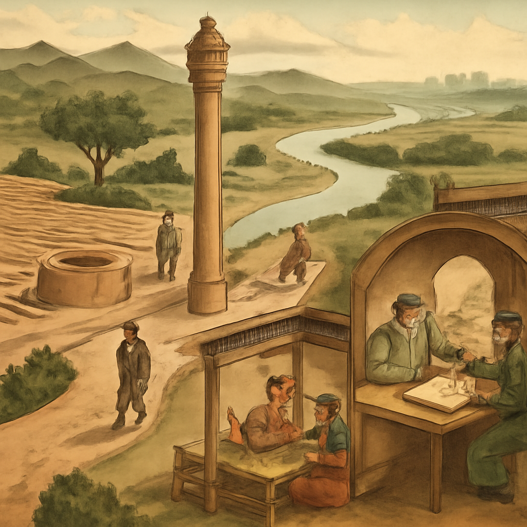
The strongest visual frame for South Asia is not one monument. The route needs an image that points to layered evidence: inscriptions, manuscripts, temples, mosques, ports, railways, salt routes, refugee trains, and river deltas. The current material-culture visual works when the caption keeps the focus on evidence and patronage, but later promotion can add maps for monsoon routes, partition movement, and regional diversity.
The reader payoff is a route that does not flatten South Asia into stereotypes. The hub lets a student move from farming and empire to inscriptions, ocean trade, anti-colonial politics, and partition. It also creates a queue for future pages on the Indus world, Delhi Sultanate, Mughal Empire, caste politics, Bengal, Sri Lanka, Pakistan, Bangladesh, and South Asian diaspora.
South Asia needs a long route because the region cannot be explained by one empire, one religion, one language, or one modern nation. Indus urbanism, Mauryan roads, Buddhist patronage, Sanskrit and Persianate court cultures, Delhi Sultanate power, Mughal administration, coastal trade, company rule, railways, anti-colonial politics, partition, and Bangladesh all belong in the same reading field. The hub is strongest when it lets readers move between deep time and modern state formation without flattening the region into a single civilizational label.
A useful South Asia reading path keeps environment and movement visible. Rivers, monsoons, mountain passes, ports, pilgrimage routes, textile towns, imperial roads, and rail lines shaped how authority traveled and where it broke down. This makes the page more than a list of dynasties. It asks how geography, labor, language, caste, trade, faith, and law turned a large region into overlapping historical worlds.
The modern endpoint also has to look backward. Partition, democracy, Pakistan, India, Bangladesh, Sri Lanka, caste politics, language movements, and diaspora histories did not appear after a clean break from the past. They reworked older institutions, memories, hierarchies, routes, and colonial categories. The hub gives readers a way to compare continuity and rupture without pretending that independence answered every question.
Read the events in order first; the page is built to reveal change over time.
Ask which pressures existed before the visible turning point and which actors had room to choose.
Follow what changed afterward in institutions, borders, law, belief, or everyday life.
Notice which events became symbols and why later generations kept returning to them.
Read rivers, monsoons, coasts, passes, languages, and local institutions before making subcontinental claims.
Use Ashoka to ask how conquest, remorse, law, inscription, and public morality can coexist.
Treat the Indian Ocean as an older trade system that European voyages entered and disrupted.
Read independence with displacement, violence, borders, citizenship, and memory instead of treating 1947 as a clean ending.
Track how language, caste, gender, class, and region shaped who could enter courts, schools, movements, and public memory.
Use Bangladesh, Sri Lanka, diaspora, and development questions to keep the story moving after 1947.
Read South Asia through rivers, roads, courts, monsoons, languages, caste, faith, trade, empire, and modern borders rather than one civilizational shortcut.
Choose a Reading Path
Start With the Timeline
Use the related timeline first when you want a chronological route through the topic.
Start with c. 10,000 BCE: Neolithic Farming ExpandsOpen a Person Page
Use people pages when the topic is easier to understand through leadership, resistance, reform, or memory.
Start with c. 322 BCE: Mauryan Empire FoundedUse Year Pages
Use year pages when you need a fast answer to what changed in a specific year.
Start with c. 260 BCE: Ashoka Turns Toward BuddhismReturn to the Map
Use the map to keep geography visible while moving between events and regions.
Start with c. 30 CE: Kushan Empire RisesAncient State Route
Begin with Maurya, Ashoka, Kushan, and Gupta to see political scale and cultural memory.
Start with c. 320 CE: Gupta Empire RisesOcean Route
Use Vasco da Gama and trade pages when the question is maritime connection and imperial pressure.
Start with March-April 1930: Salt MarchMovement Route
Read the Salt March and independence pages for mass politics, civil disobedience, and state formation.
Start with August 1947: Indian Independence and PartitionPartition Route
Return to 1947 when reading rights, migration, violence, and postcolonial citizenship.
Social Reform Route
Follow caste, gender, language, education, and labor when the question is who gained voice inside political change.
How the Story Builds
Begin with Neolithic Farming Expands. The opening event usually shows the pressure that made the route necessary: a crisis of authority, an expanding exchange system, a new technology, a contested idea, or a conflict that older institutions could no longer contain.
Gupta Empire Rises works as a checkpoint because it lets readers ask what had become irreversible, which actors still had choices, and how the route changed scale between the opening event and the later consequences.
The later edge of the route includes Vasco da Gama Reaches India, Salt March, and Indian Independence and Partition. These pages help readers see what survived beyond the first shock: institutions, borders, laws, memories, technologies, movements, or arguments that kept shaping later history.
The route is easier to remember through people and places. Watch figures such as early farming communities, Chandragupta Maurya, Ashoka, Kujula Kadphises, Yuezhi groups, and Chandragupta I move through settings such as Fertile Crescent, Pataliputra, Kalinga, Bactria, and Magadha; that is where large structures become visible as choices, risks, costs, and memories.
Early agriculture, rivers, monsoons, and regional ecologies establish the deep setting.
Maurya and Ashoka show armies, administration, inscriptions, and moral communication.
Kushan and Gupta connect South Asia to Central Asia, Buddhism, court culture, and Sanskrit memory.
Indian Ocean routes and European entry expose older trade systems to new coercive powers.
Salt March and 1947 connect mass mobilization, colonial withdrawal, borders, and trauma.
Bangladesh, Sri Lanka, diaspora, development, and language politics reveal why sovereignty did not settle belonging.
- Which event in South Asia feels like the true point of no return, and why might another reader choose a different event?
- What changes if the route is read from the perspective of ordinary people rather than rulers, armies, inventors, reformers, or institutions?
- Which consequence was immediate, and which consequence only became clear decades later?
- Where does the map change the interpretation by showing distance, borders, routes, ports, capitals, or frontiers?
- How can South Asia be read as a region without erasing its internal diversity?
- What makes Ashoka's memory politically powerful and historically complicated?
- Why does the Indian Ocean matter before European empire?
- How did civil disobedience turn ordinary materials into political symbols?
- Which future South Asia pages are needed before the route is fully balanced?
- How do caste, gender, and language change the meaning of political independence?
- Why does 1971 belong in the same regional conversation as 1947 without becoming the same story?
- How does South Asian history change when Indus cities, Mauryan inscriptions, Mughal administration, colonial railways, and partition are read together?
- Which older institutions and social structures survived into modern South Asian politics, and which were remade by colonial rule and independence?
Interactive Timeline
Follow South Asia by sequence
Neolithic Farming Expands
Farming and settled village life expanded in parts of Southwest Asia, changing human relationships with plants, animals, labor, storage, risk, and landscape.
Read the full event pageMap Layer
South Asia geography
Gold pins mark the approximate locations of published event pages. This is a schematic locator map, not a historical border map.
Coordinates are approximate and are used to help readers orient themselves before opening a full event page.
Route Events
Events in This Topic
Neolithic Farming Expands
Farming and settled village life expanded in parts of Southwest Asia, changing human relationships with plants, animals, labor, storage, risk, and landscape.
Mauryan Empire Founded
Chandragupta Maurya founded the Mauryan Empire, creating one of South Asia's largest early imperial states after the decline of older kingdoms.
Ashoka Turns Toward Buddhism
After the Kalinga War, Ashoka promoted Buddhist ethics and imperial moral rule through inscriptions and public policy.
Kushan Empire Rises
The Kushan ruling line emerged from Yuezhi groups in Bactria and built a state linking Central Asia, northern India, and long-distance trade routes.
Gupta Empire Rises
The Gupta dynasty rose in northern India, building a durable imperial order from the Ganges heartland.
Vasco da Gama Reaches India
Vasco da Gama reached India by sea from Europe, opening a Portuguese route into established Indian Ocean trade networks.
Salt March
Mahatma Gandhi led a march to the sea to protest Britain's salt monopoly, turning a common commodity into a symbol of colonial resistance.
Indian Independence and Partition
British India became independent as India and Pakistan, while partition produced mass migration, communal violence, and unresolved border questions.
References
Where to Check the Facts
- Encyclopaedia Britannica: History of IndiaReference for South Asian chronology from early states through colonial rule and independence.
- The Metropolitan Museum of Art: South Asia timeline essaysReference for South Asian art, political history, religion, and regional periodization.